Following the adventures of our first Tale – the second takes us deep into the heart of my childhood exploring the history and ecosystem of the unique area where I grew up.
After the Mesascale Convective Vortex filled up the Indian River Lagoon, it provided Jake and I with a unique opportunity to explore the Thousand Island using Lark’s Tongues in Aspic, our 15 foot Key West runabout. Normally the water would be too low to go deep into the islands which normally have only a couple of feet of water.
We had a great ride through the south and north sections of the islands. These are naturally divided by the golf course complex that was built on dredged land in the 1960s. This includes the junior and senior high schools I went to, city offices, the water reclamation plant, home sites, the swimming pool I have been swimming at since 1964, and other recreational activities.
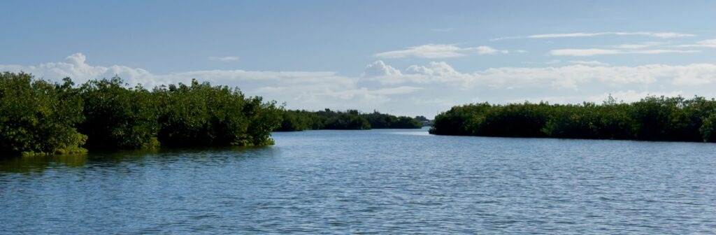
With the Atlantic Ocean as my front yard and the Indian River Lagoon as my backyard, growing up watching rockets launch from a barrier island shaped my entire existence on this beautiful blue marble.
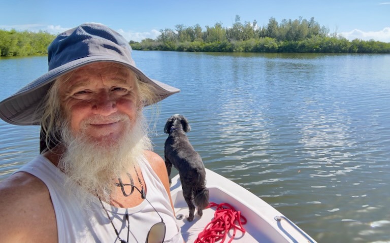
Our house at the end of Convair Cove was just a short swim or a couple hundred feet by boat from the nearest of the Thousand Islands. My brothers and I began exploring them early in our childhood. I would spend hours wandering the islands and salt flats with their mosquito canals. Despite the heat, dirt, and bugs (especially those damn mosquitoes), it remains one of the fondest memories of my youth.
A History of the Thousand Islands of Cocoa Beach

The Cataclysmic Genesis
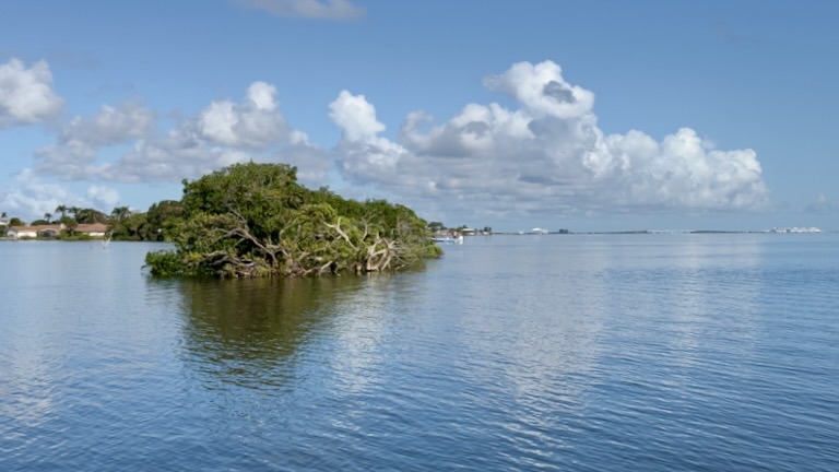
The Thousand Islands form a 900-acre flood-tide delta deposit in the Banana River Lagoon. While charts from the mid-19th century lacked the resolution to map the finer details of the shoals, modern sediment core sampling has revealed their dramatic geological origin.
Over 2,000 years ago, a massive, cataclysmic storm breached the barrier island’s protective dunes. The ocean sliced a temporary inlet directly through what is now Minutemen Causeway. As the violent Atlantic surf forced its way inward, it deposited a massive, uneven layer of plain sand mixed with terrestrial plant debris over the existing lagoon floor.
Once the inlet naturally closed, this shallow sand delta became the perfect canvas for nature. Red mangroves colonized the shoals, their complex prop roots trapping sediment and decaying organic matter. Over centuries, this process built up a sprawling maze of shallow mangrove atolls, salt marshes, and maritime hammocks.
Living with the Tide
Long before any modern engineering altered the landscape, the indigenous Ais people utilized these islands as a vital foraging ground. As a fisher-gatherer society, they relied heavily on the estuary’s seasonal abundance of shellfish, crabs, and finfish.
The legacy of the Ais remains visible today via the extensive oyster-shell middens scattered throughout the hammocks. These high mounds of discarded shells unintentionally raised the topography of specific islands, creating stable, elevated upland soil. Over time, these middens allowed tropical hardwood hammocks to take root, providing permanent high-ground structural stability amid the shifting, ephemeral marshlands.
The Early Years of Cocoa Beach
By the early 20th century, the heavy concentration of local black ducks, bluebills, and other migratory waterfowl turned the Banana River shoals into a premier winter hunting ground.
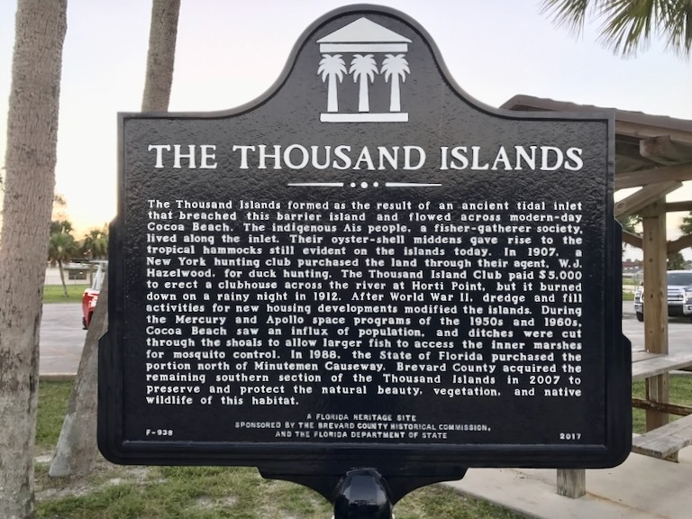
In 1907, a wealthy group of New York sports hunters purchased a significant portion of the land through a real estate agent and formed the Thousand Island Club. They paid the substantial sum of $5,000 to construct a large, dedicated duck hunting clubhouse across the river at Horti Point. The remote lodge served as a premier winter retreat for northern elites seeking unregulated access to the teeming flocks of the lagoon. However, the structure’s history was short-lived; on a rainy night in 1912, the original clubhouse caught fire and burned to the ground, leaving the islands to revert to a quiet sanctuary for a few more decades.

Reshaping the Marsh
The most permanent structural changes occurred during the Space Boom of the late 1950s through the early 1970s, when a massive population influx hit Brevard County. To make the coastal strip habitable, the county had to wage an aggressive war against the saltmarsh mosquito.
The Late 1950s (Source Reduction Ditches): Workers initially hand-dug and lightly dredged small, narrow ditches through the interior of the succulent marshes. The primary goal was to allow constant water movement and grant predatory fish (like minnows and killifish) access to the isolated interior ponds where mosquito larvae flourished. This phase had minimal impact on the overarching plant communities, simply allowing mangroves to line the new ditch edges.
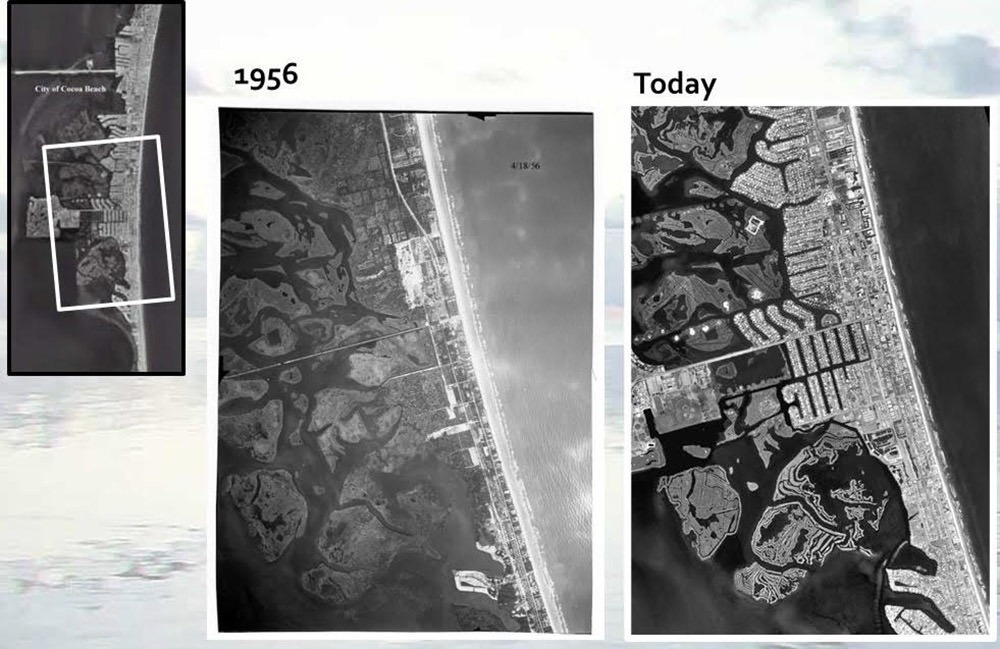
The Late 1960s to Early 1970s (The C-34 Impoundment): Frustrated by limited success, the Brevard County Mosquito Control Board pivoted to aggressive dragline dredging. South of Minutemen Causeway, they systematically dredged massive canals and threw up heavy earthen dikes to form the C-34 Mosquito Impoundment. Concurrently, private developers aggressively dredged residential canals, dumping the heavy upland spoil onto portions of the islands to prep them for housing subdivisions that were ultimately never completed.

Infrastructure Crisis
The massive population influx of the Space Boom abruptly transformed Cocoa Beach from a quiet sandbar into a booming community, quickly pushing the fragile barrier island ecosystem and its primitive waste management past their breaking points.
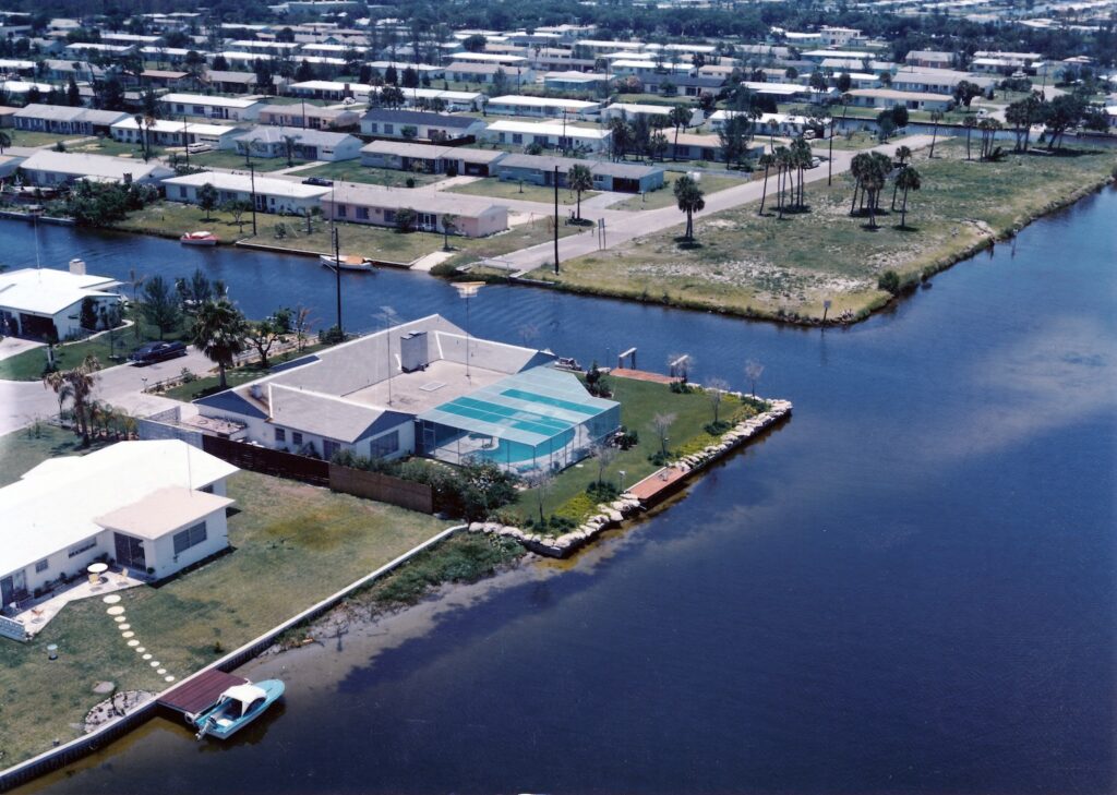
The Convair Cove Facility
Before operations were centralized, early neighborhood development relied on smaller, localized treatment systems. In the 1950s and early 1960s, a primary septic and secondary sewage processing facility stood at the western edge of Convair Cove—the exact footprint where Dempsey Park stands today.
As the facility became obsolete and struggled to handle the surging neighborhood load, it was eventually decommissioned.
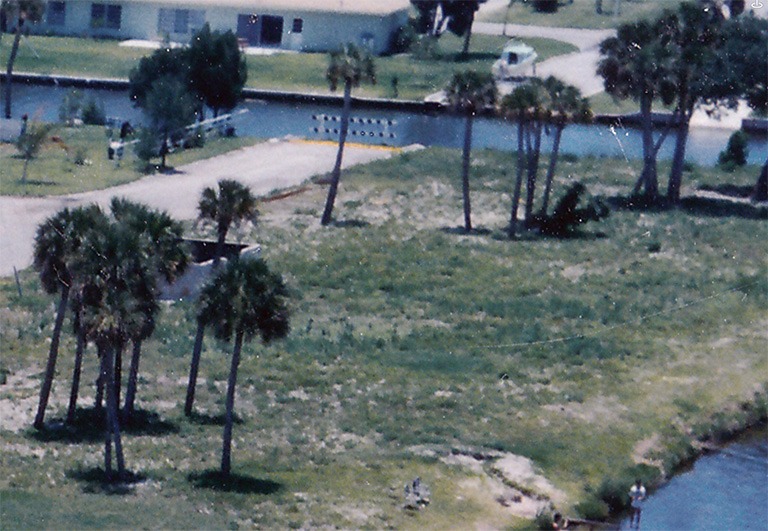
For a period in the late 1960s, the hollowed-out, concrete skeletons of the processing tanks and building foundations remained completely exposed. This industrial ruin became an adventurous, if hazardous, playground for local neighborhood kids who climbed through the structure before the city completely cleared the site, buried the remaining infrastructure, and repurposed the waterfront land into a public park.
1960s Contamination & Health Advisories
The decommissioning of these older neighborhood plants coincided with a severe ecological breaking point in the surrounding waters. For years, partially treated effluent from local plants and failing residential septic systems leaked directly into the shallow, slow-moving waters of the Banana River and the Thousand Islands.
By the late 1960s, the water became noticeably dirty, thick, and discolored, prompting the county to issue strict health advisories warning residents to stay out of the lagoon. I remember swimming and frequently emerged from the water covered in a distinct, foul residue—slimy, green-and-brown algal strands that clung stubbornly to the hairs on my arms and legs. This slime was the direct result of massive, nutrient-fueled algal blooms, sparked by the high concentration of nitrogen and phosphorus from human waste saturating the stagnant, un-aerated backwaters of the dredged islands.
The Centralized Waterworks Project
Recognizing that the localized septic facilities were entirely inadequate and poisoning the tourist-dependent estuary, the city initiated a massive, forward-looking civil engineering project at the far western end of Minutemen Causeway
Initial construction began in late 1959 when the City Commission authorized a system expansion contract. Crews spent the early 1960s radically re-engineering the western tip of the causeway, clearing out natural wetlands, digging utility corridors, and building the initial biological treatment tanks
The core construction phase lasted approximately three to four years.
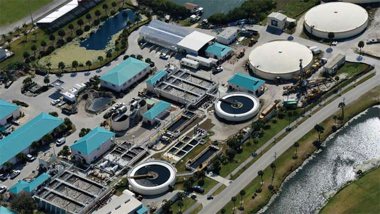
Over the subsequent decades, this site underwent continuous expansions, evolving from that initial mid-century concrete footprint into the massive, high-tech water reclamation facility that stands at the end of the causeway today—a critical barrier preventing millions of gallons of raw waste from freely dumping into the Thousand Islands.
The Ecological Toll and Aftermath
The transition from a natural flood delta to an engineered grid had a devastating, immediate impact on the local ecosystem. The deep canals and high spoil dikes permanently eliminated the natural, seasonally flooded ephemeral pools.
By choking off the natural tidal exchange, the native wetland vegetation was nearly decimated, reduced to a thin, struggling fringe of mangroves along the sharp edges of artificial canals. The higher ground created by the dredge spoil was rapidly overtaken by aggressive, non-native upland plant communities and invasive species like Brazilian Pepper, completely erasing the delicate saltmarsh biodiversity.
Furthermore, sealing off the marshes inside impoundment dikes blocked the historical nursery pathways for juvenile tarpon, snook, and blue crabs, altering the food web of the wider Indian River Lagoon for generations to come. It wasn’t until preservation acquisitions in 1988 (North) and 2007 (South) that the tide finally turned back toward conservation and active mangrove restoration.
Muck
The intensive, ongoing push to clear the bottom of the Indian River Lagoon addresses legacy muck, a thick, black, nutrient-dense sediment colloquialized by locals as “black mayonnaise”. Over the past 40 to 60 years, rapid human development and increased freshwater runoff have funneled topsoil, construction site clays, lawn fertilizers, and organic waste directly into the stagnant estuary. As this trapped matter decomposes alongside dying algae blooms, it forms a fine, oxygen-depleting ooze that blankets thousands of acres of the lagoon floor.
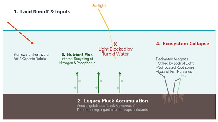
This accumulation creates a destructive internal pollution loop. The muck continuously releases massive loads of nitrogen and phosphorus back into the water column, fueling a cycle of toxic algal blooms and critical drops in dissolved oxygen. Furthermore, because it easily suspends into a cloudy soup when disturbed, the muck blocks essential sunlight, effectively choking out native seagrass beds and destroying benthic wildlife habitats.
To neutralize this foundational threat to the estuary, Brevard County’s Save Our Indian River Lagoon initiative relies on two distinct structural remedies:
Large-Scale Environmental Dredging
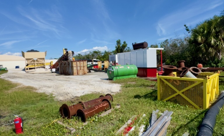
The primary historical tool has been physical removal. Dredging vessels systematically vacuum millions of cubic yards of legacy muck from deep navigation channels, residential canals, and river mouths. The extracted “black mayonnaise” is pumped through miles of floating pipelines to specialized upland management facilities where the water is separated, chemically treated to remove microscopic pollutants, and safely returned to the lagoon, permanently stripping the legacy nutrients from the system.
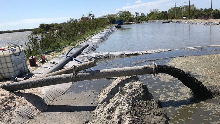
On the north side of our backyard was a large, raised island created from fill we would play on as it was devoid of vegetation. I remember a firecracker blowing up in my hand once while playing there. Ouch!
When I came back in the mid 2010s i discovered it was ground zero for this dredging. This is there the muck was deposited, processed and eventually hauled away. At the peak i remember a 15 foot mound of the stuff covering the whole area. They brought in heavy equipment by barge to process it.
The Sand Capping Restoration Project
For open-water sites where deep mechanical dredging poses too great a risk of stirring up toxic particulates or is economically unfeasible, the county is deploying an innovative alternate strategy.
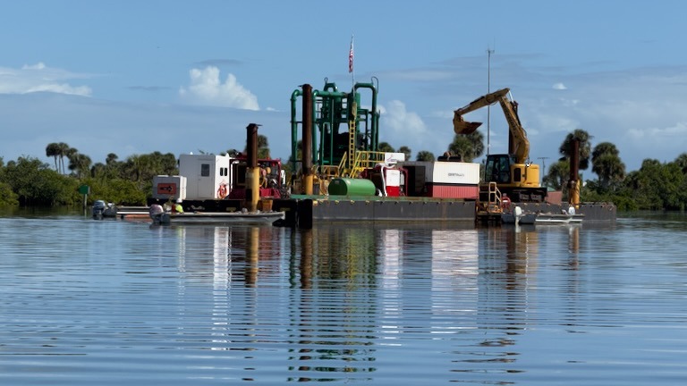
Instead of extracting the sediment, specialized barges are systematically pumping a foot-thick layer of clean, heavy sand—roughly 400,000 tons—directly over a 140-acre muck deposit. This sand cap acts as a physical and chemical blanket:
- Isolating Nutrients: It physically separates the rotting muck from the overlying water, blocking nitrogen and phosphorus from leaking back up into the lagoon.
- Restoring the Benthic Floor: It instantly recreates a natural, stable sandy bottom that allows native seagrasses to take root, provides clean ground for oyster cultivation, and restores vital fish habitats without disturbing decades of legacy pollution.
Living Shorelines and the Stormwater Challenge
The modern chapter of the Thousand Islands focuses on active biological reclamation, transitioning the area from a legacy of heavy industrial dredging toward an interconnected, living estuary. This effort relies on collaborative ecological restoration centered around the shores of Convair Cove and Dempsey Park, though it continuously faces the persistent structural friction of urban stormwater management.
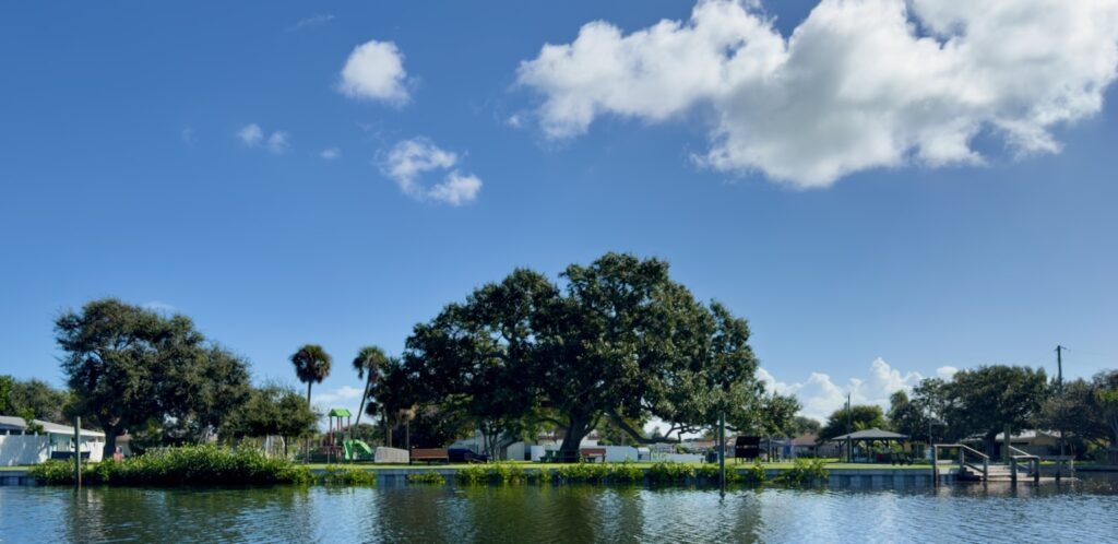
Dempsey Park Living Shoreline & Mangrove Repopulation
Following the complete clearing and conversion of the old septic processing site into Dempsey Park, the hardened, eroded shoreline became a primary target for modern habitat restoration. Recognizing that vertical seawalls offer zero biological utility, environmental groups and municipal teams initiated a “living shoreline” project along the park’s western waterfront.
Volunteer crews systematically removed thickets of invasive Brazilian Pepper and stabilized the banks by planting native vegetation. Red and black mangrove propagules were meticulously introduced along the intertidal zone. As these mangroves repopulated the shoreline, their expanding, dense prop-root systems effectively anchored the shoreline against wave action and created a critical, sheltered nursery habitat for local marine life, transforming the park’s edge back into a functional wetland fringe.
Oyster Reef Development
To naturally combat the chronic nutrient and turbidity issues plaguing the shallow waters surrounding the park, restoration efforts expanded into the sub-tidal flats through large-scale oyster bed cultivation. Using recycled shell bags stacked in strategic, interlocking formations, conservationists built artificial reef templates just offshore from the newly established mangrove lines.
These constructed beds served as a clean substrate for native oyster larvae to settle and grow. The thriving oyster communities act as a profound, self-sustaining biological filter for Convair Cove. A single adult oyster can filter up to 50 gallons of water a day, working continuously to strip out suspended solids and volatile organic nutrients, drastically improving localized water clarity and establishing an essential trophic foundation for crabs, shrimp, and foraging finfish.
McNabb Parkway
The road beside our house always had an unusual layout. It was originally designed as a cross street connecting several residential neighborhood roads, until developers dug two canals—including ours—that sliced it completely apart. At the time, those developers had grand plans to expand onto the neighboring islands. When those plans fell through, they simply threw up permanent “End of Road” signs and walked away. For years, the street ended at a struggling little sand spit where my dad used to dump his old motor oil.
Eventually, the city cleared out that sand spit. About ten years ago, they launched a major project to better filter the heavy stormwater runoff flowing into the lagoon. Along with adding attractive, vegetated holding ponds to clean the water, the city decided to replace the street’s traditional asphalt with interlocking paver blocks to improve drainage and boost neighborhood aesthetics.
Instead, the project turned into a major civic and financial failure. Because of poor base compaction and shifting sandy subsoil, the pavers quickly buckled and sank under normal traffic, leaving behind an uneven, hazardous road. Worse yet, multi-phase construction delays and oversight bottlenecks dragged the timeline out so long that the contractor’s formal warranty quietly expired before the city could file a claim. Left with no legal recourse, the city had to foot the entire bill—forcing local municipal and Brevard County taxpayers to pay twice to tear out the failing pavers, stabilize the roadbed, and repave the street all over again.
Win some, lose some, it seems.
I consider myself lucky to have been able to grow up in this environment. I started my love of nature and exploration of the world.
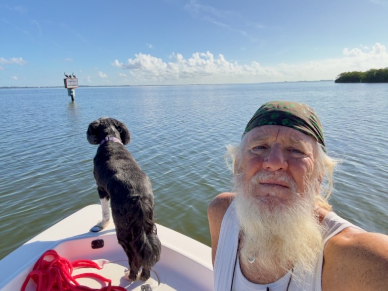
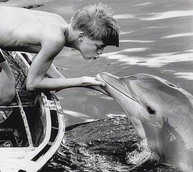
I used to love watching Flipper, filmed in the Key, and image I was the boy Sandy living his life with Flipper down under the sea.