We left Arco and headed southeast toward the Salt Lake area. The morning sun was fantastic on the mountain range to the northwest of Arco.
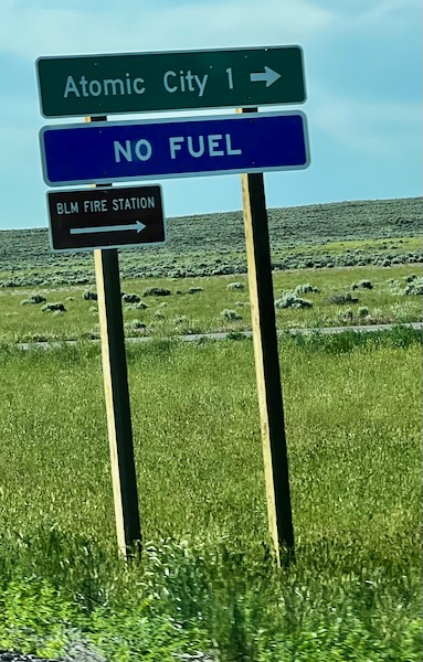
The drive took us the same way as we went yesterday. We passed the turnoff for Atomic City. If it were not a mile off the road, I might have a look. According to what I can find online, there isn’t much, and it’s not precisely clear if and when what’s there is actually open! One thing is for sure – no gas. Maybe they can fill up my nuclear reactor!
This took us eventually to the Interstate and south to Utah. Some of the views are broad valleys with all colors of green against mountains and forests. It reminded me of places I have seen in Switzerland.
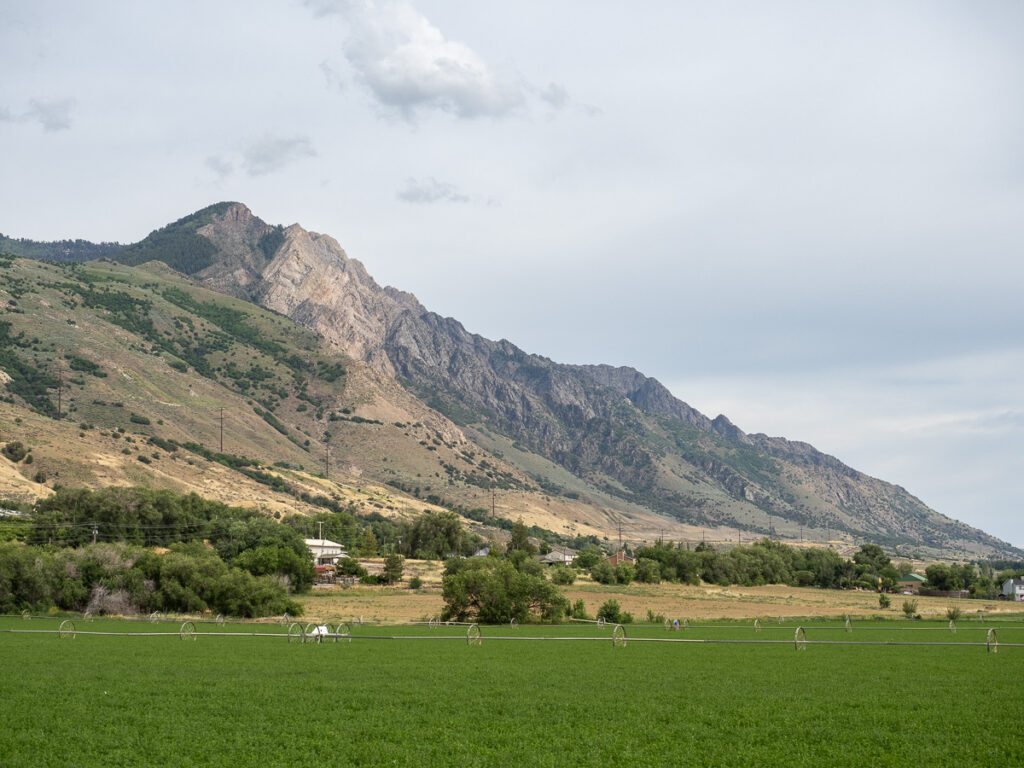
Brigham City
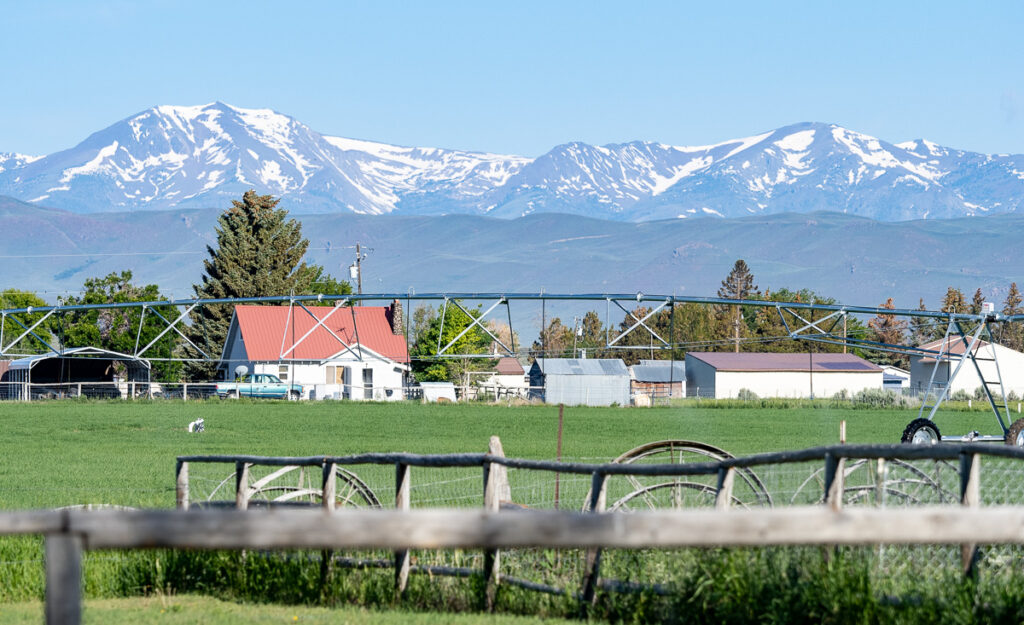
I returned to an RV Park I stayed at in 2021. It was just north of a stunning view of the Wassach Mountian range east of Ogden.
We tried to see some of Salt Lake but didn’t want to pay $20 for just the view at the nearby state park. I never did get to see it as we left early the next morning after a quiet evening.
We left only to drive nearly 100 miles in Friday morning traffic through Ogden, Salt Lake City, and Provo on Interstate 15. A good chunk of that 100 miles is a 7-lane raceway with trucks zooming by. Fortunately, there were no slowdowns, and we eventually started to climb the Wassach Mountian range on Highway 6 just south of Provo.
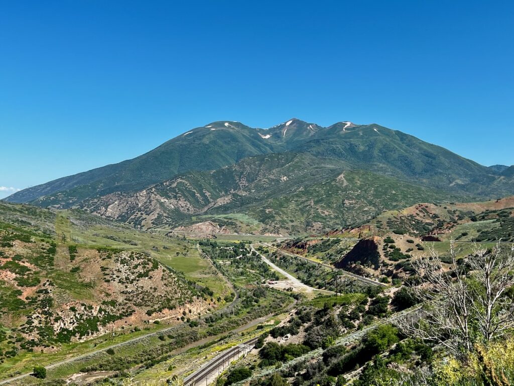
And what a sight it was! Stunning photos at Solider Summit.


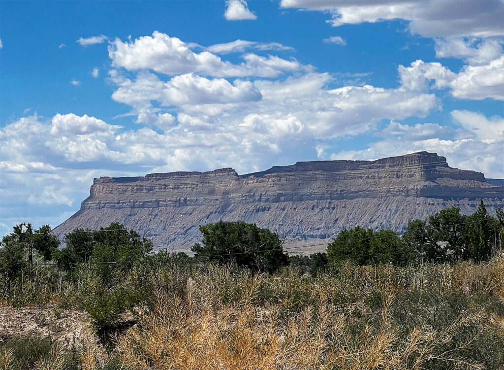
After the pass, the scenery quickly becomes more desert-like with the typical eroded buttes. We pass through a broad open basin with a mountain range to the east.
Green River
Green River is a gateway to Arches National Monument. We will travel that way on the next leg of our journey to Monument Valley. It is so named because it sits on the Green River. We visited the Green River further north on our trip to Vernal and Dinosaur National Monument in 2021
Green River itself looked like it had seen better days. A lot of boarded-up buildings. More than likely, all the newer motels on the Interstate. It is the start of the week-long 4th of July celebration; I expect the place to fill up.
We took a walk to the nearby river in the morning. The water was flowing swiftly and was very muddy.

In addition to being an important railroad stop, Green River was home to uranium mining and had a missile launch complex associated with White Sands. The camp host told me they stopped because the people of Moab, a town to the southeast, didn’t want rockets flying over their town!
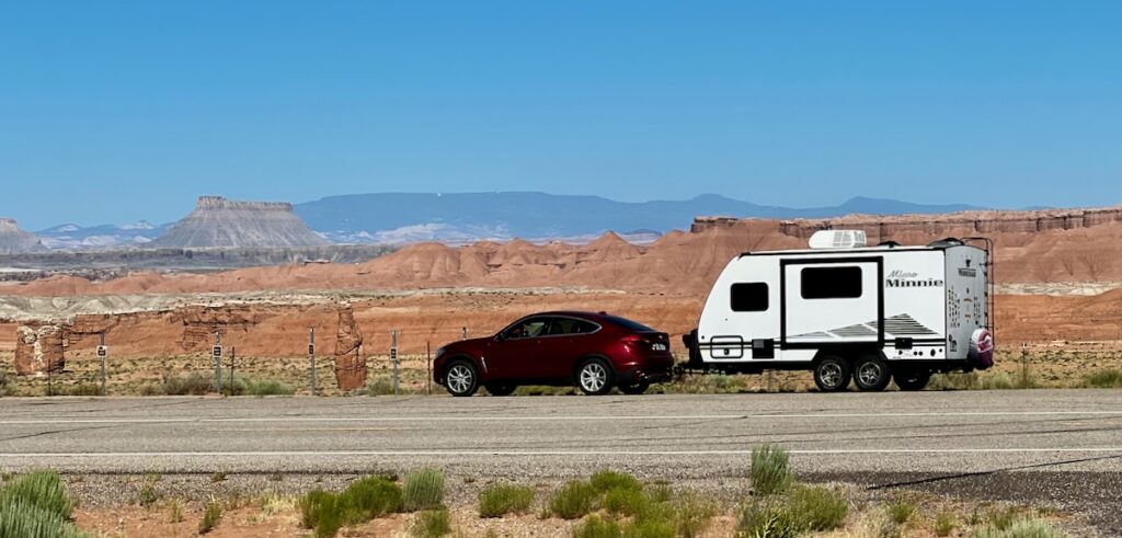
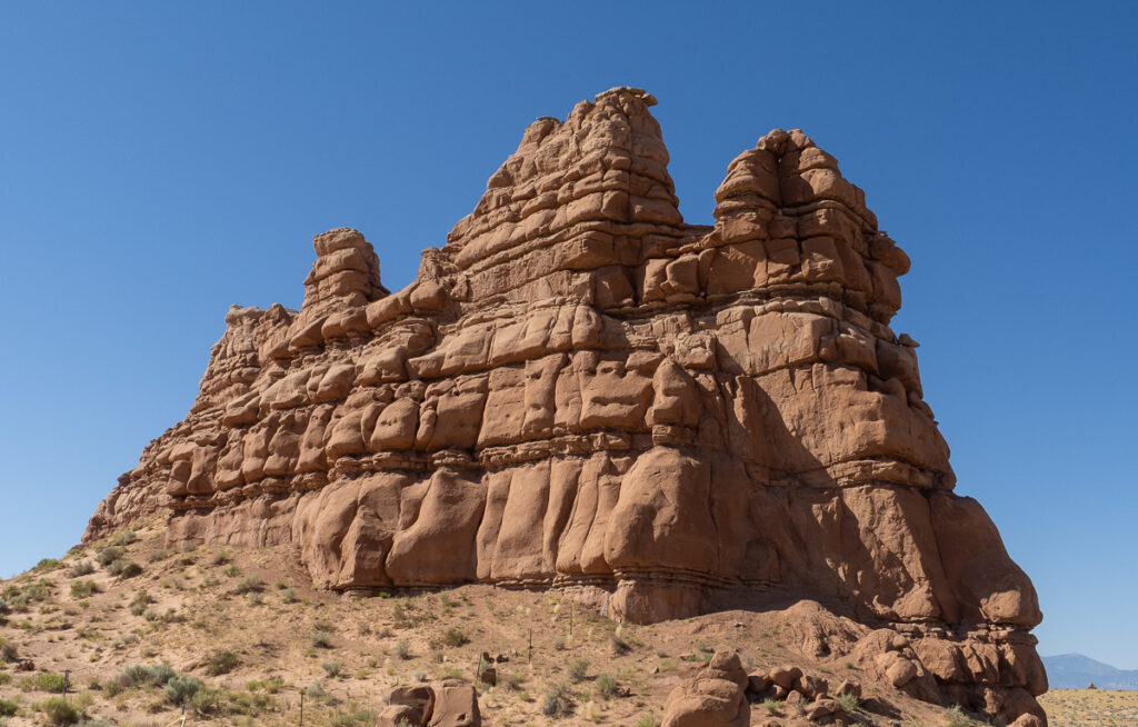
We left early the next trying to get a jump start on what was supposed to be a 100F day. The first part of the journey on Highway 24 took us by Kathleen Rock.
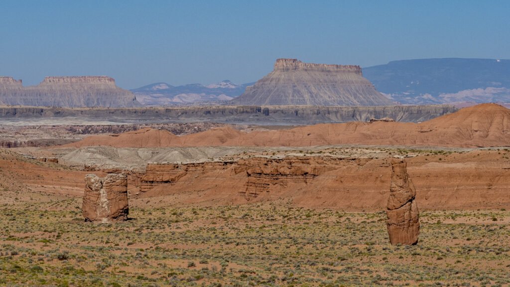
From there to Highway 95 through Glenn Canyon Recreation Area. This was a fantastic drive through a canyon leading to a spectacular overlook of the Colorado River.


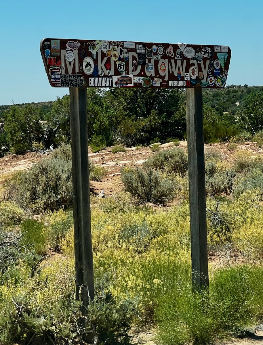
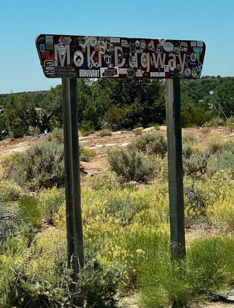
From there, we drove through Fry Canyon to the entrance to Natural Bridges National Monument. From there, we drove the Trail of the Ancients until we (surprise!) came to Moki Dugway.
Moki Dugway
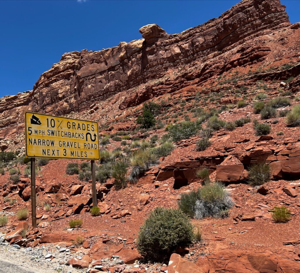
The Trail of the Ancients is byways associated with the Anasazi peoples. This part of the trail starts at Ceder Bluff and winds – precariously – down the bluff to the valley below. The Valley of the Gods, home to Monument Valley.
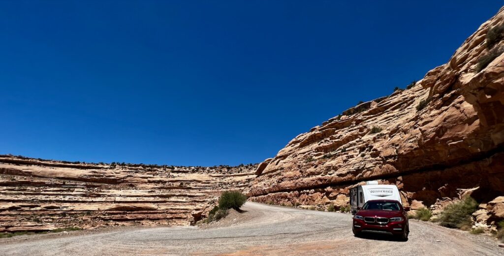
When we started down the road, I saw a large sign warning me of gravel roads with 10% grades. If I had known, I might have turned back. As it was, we went ever so slowly down the very, very steep grade, finally reaching the bottom some three miles later. I was proud of Starship Excellent Adventure with her new boots. She handled it like it was child’s play!


Valley of the Gods
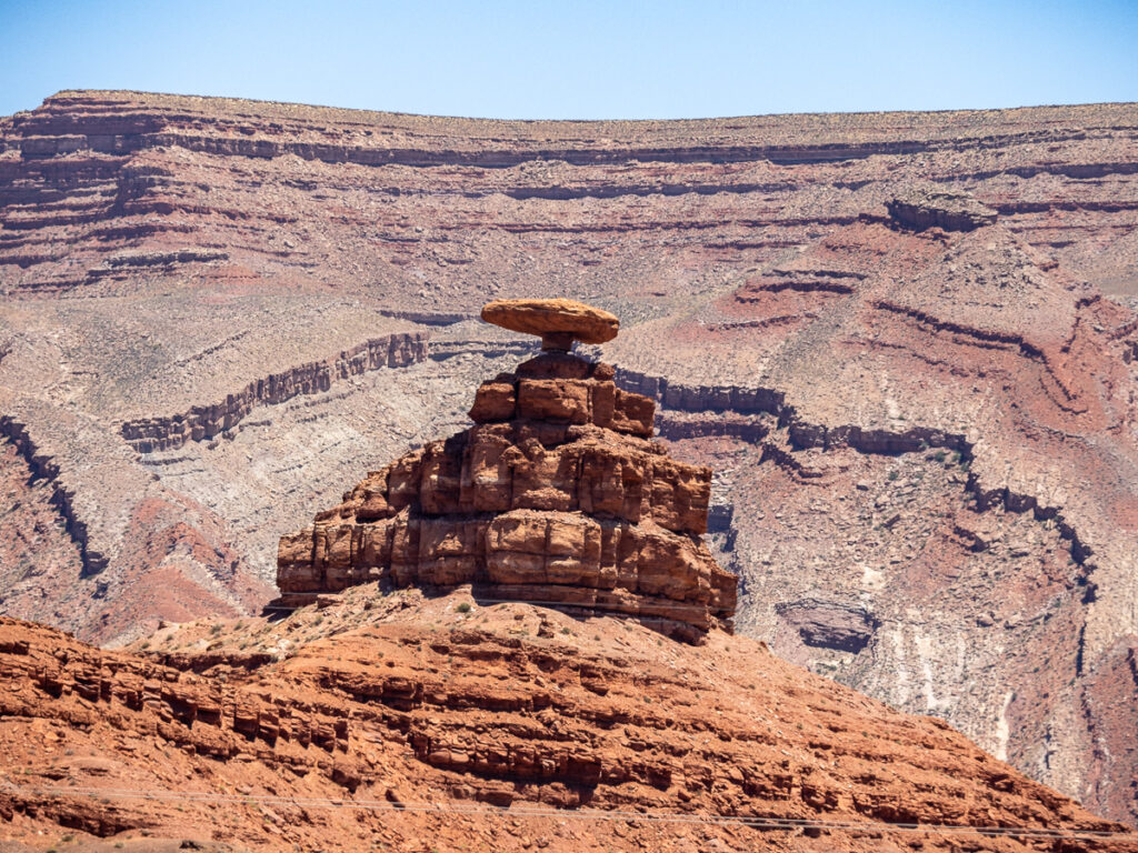
After that eye-opening experience, we made our way to Monument Valley. We passed through Mexican Hat with a stop at the famous rock formation after which the town was named (or was it vice versa?)
We finally climbed the grade and dropped down on the famous view.
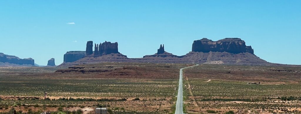
This spot is famously known as Forrest Gump Hill. Thongs of people taking pictures stood in the middle of the roadway. I have to say; there is hardly a more epic scene than this one with the highway leading to the monuments. It was burned in my brain from my trip here in the early 1990s.
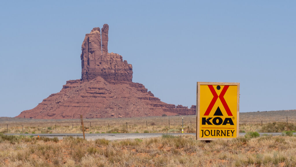
The KOA was set right in the middle of the standing monuments. We looked forward to our next two days of exploring this stunning display of Mother Earth.