Tse′ Bii’ Ndzisgaii

I had the occasion to hear two Navajo women talking at the local gift shop. I wanted to listen to them all day; their language is so beautiful.

Tse′ Bii’ Ndzisgaii is the name of this area in the native tongue of the native people. The highway that runs through Monument Valley is called Navajo Code Talker Highway. They take pride in this unique contribution to the country that tried to break their spirit through cultural assimilation. A ‘fuck you,’ but in a dignified way. I like it.

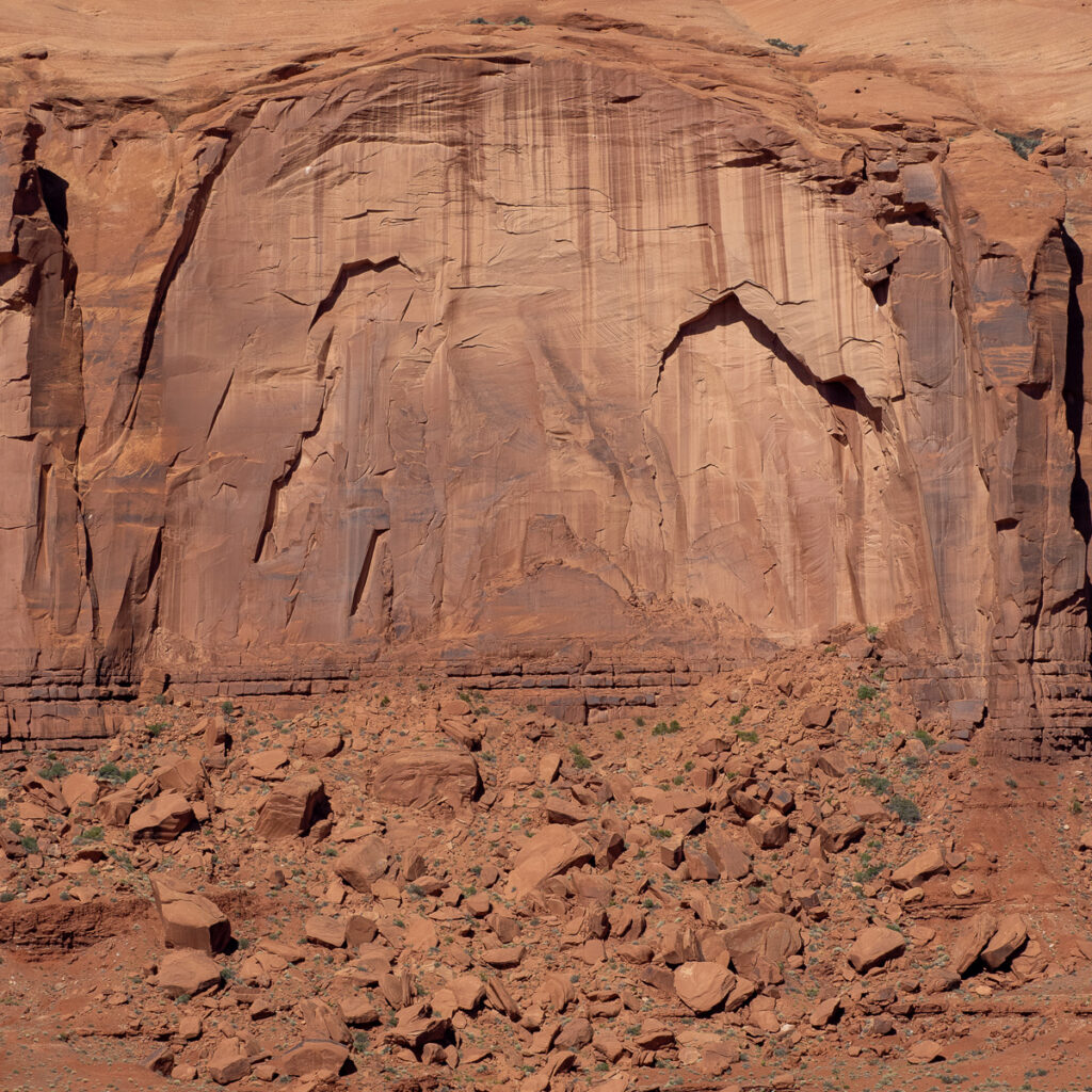
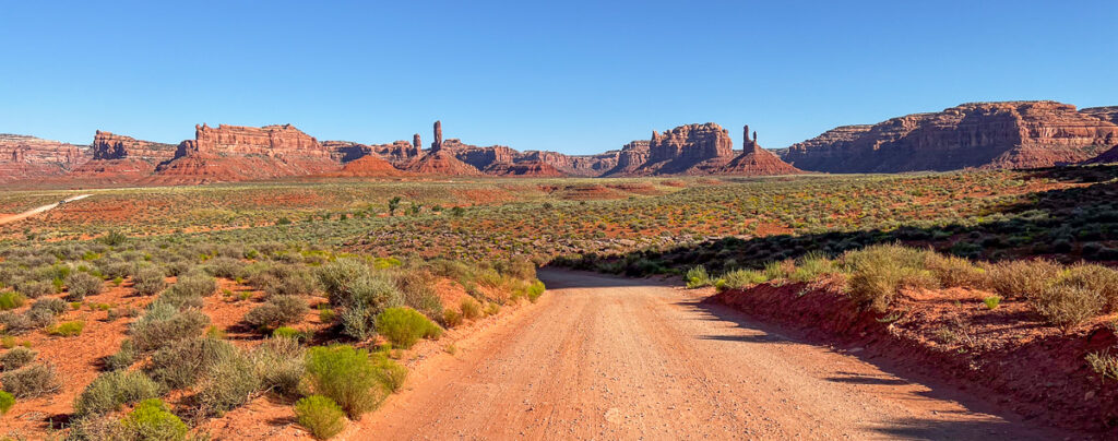
The leading group of monuments sits in the Navajo Tribal Park, but they are everywhere in the broad plain across southeastern Utah. The elevation here is one mile. There are three formations: the Mesa, which looks like a tabletop; the Butte, which is smaller and more eroded; and the Spire which is the last stage as the rock becomes narrow and freestanding. They range in height from 500 to 1,500 feet.

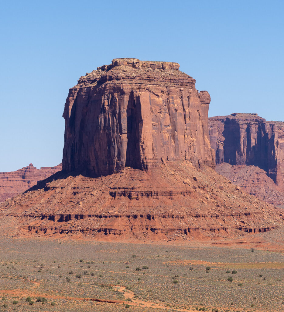
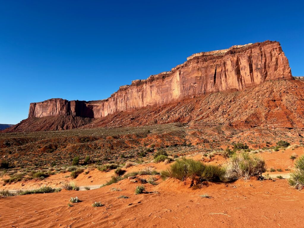
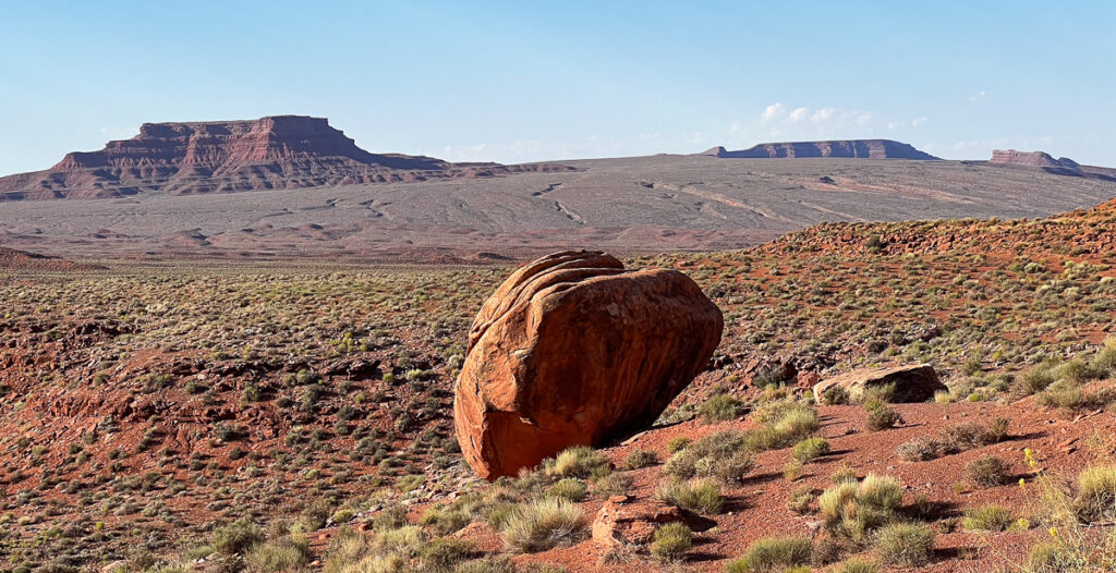
When you get near their base, you can find boulders as big as a bus, rocks seemingly placed by some massive being in random places. Spires that look like they could topple over in a bad windstorm. Can you imagine seeing one fall?

Valley Of The Gods iPhone

You can stay in lodging on the park run by the Navajo or in a lodge in an area famous for its role in the Westerns of the 1940s through 1960s. John Ford and John Wayne are big names here. The memorabilia is fascinating and runs through relatively modern times.


The RV Park was just on the northern outskirts of the tribal park. The views were fantastic.

The camp host was a native. Although she could not speak Navajo, she knew the tribal names of her people. She is petitioning the tribal government for her own chunk of land, which is her right. She told me they had to stick a large pipe in the Mexican Hat Rock to keep it from falling off!


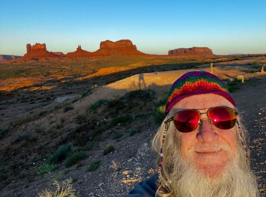
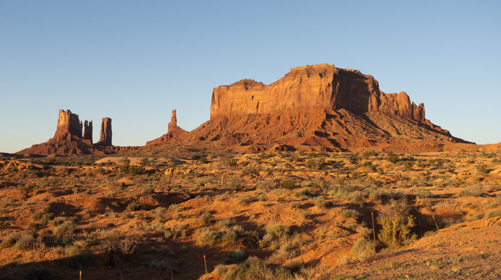
On this first day, we got up early and watched the sunrise on the monuments. Breathtaking!

Monument Valley Sunrise – The Dude 😎
Monument Valley Sunrise

We then toured Tribal Park. Eight bucks get you in with your car.

Monument Valley Loopp Drive. It costs $8 to drive the loop yourself. Otherwise, there are dozens of tour guides with converted pickup trucks.
Monument Valley Loop Drive – Mitchell Mesa

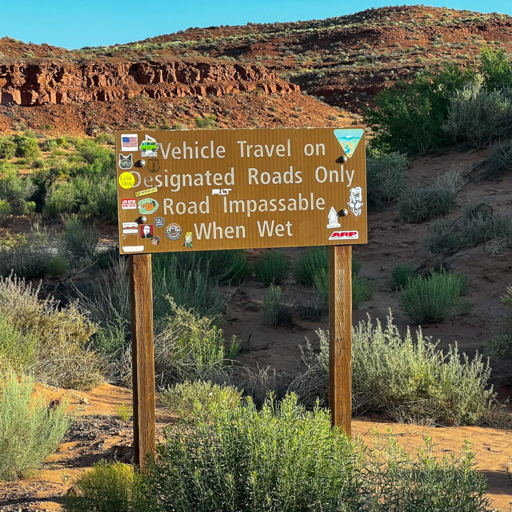
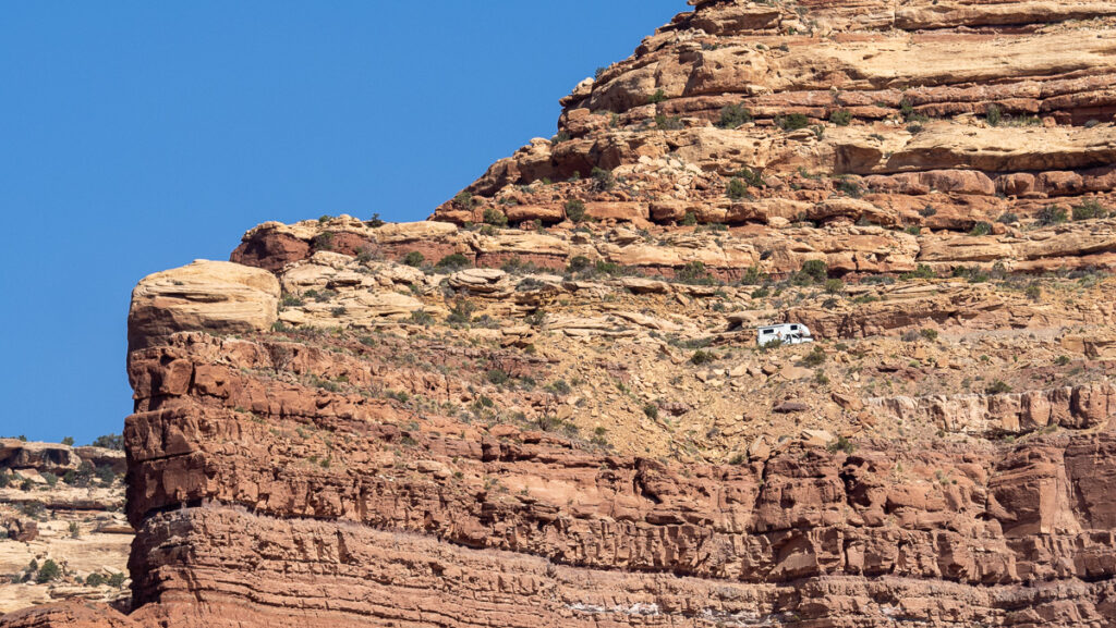
The Starship Excellent Adventure navigated the relatively smooth dirt, rock, and gravel rock. They must keep the road up because I saw a fleet of about 25 converted pickup trucks that will take those without the right car or guts to drive it themselves.

All the formations have names. Like cats, though, they have the name someone gives them and their real names.

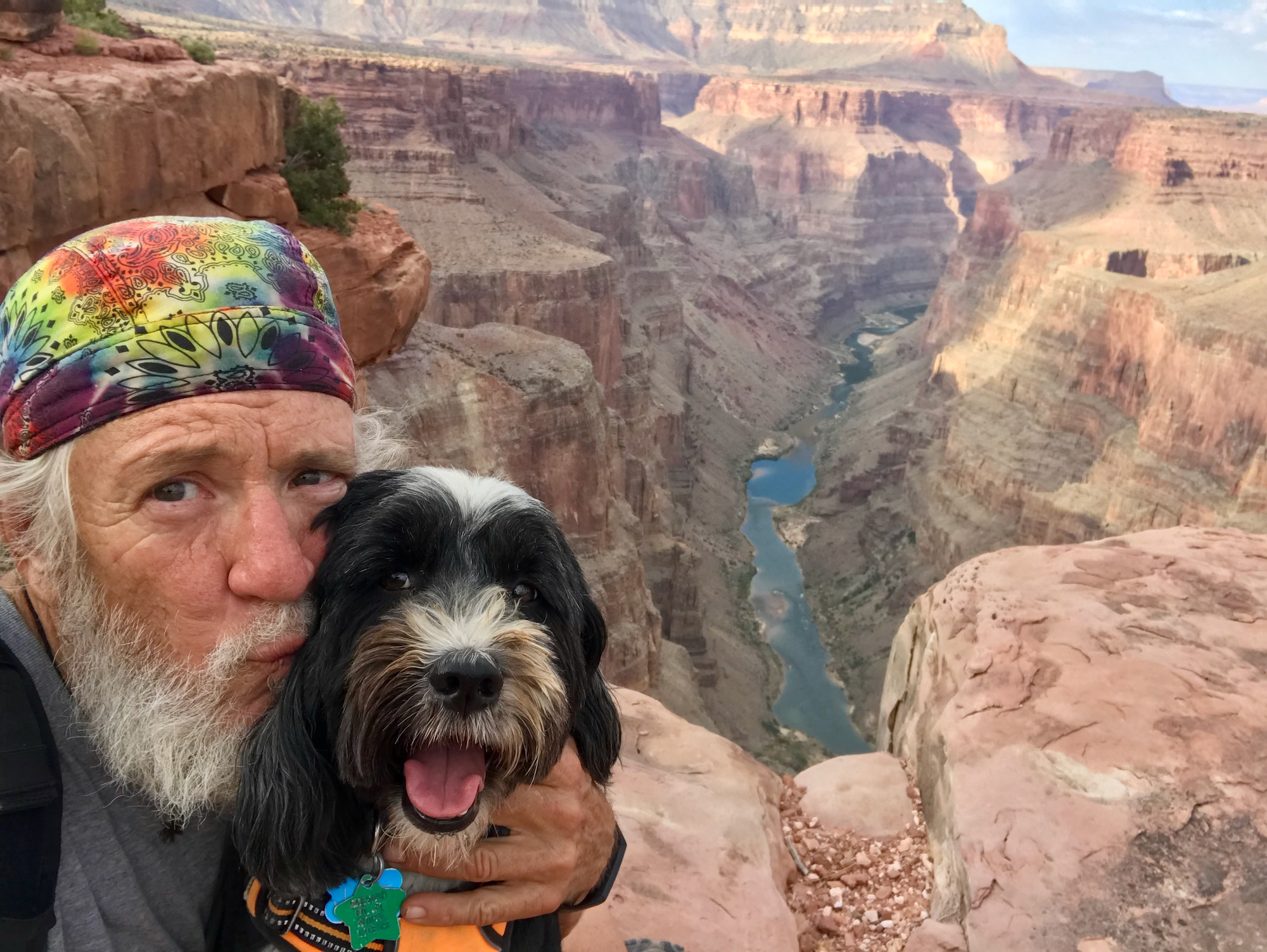
I like to think only they and a few select groups of dedicated Navajo know them. Families lived here; I saw several homesteads and roads leading off with signs to keep out. No hiking allowed!

I marveled at some of these sheer faces. I imagined seeing pictures in them. What did the native peoples see in them? Images of nature, I would think. Or spirits.

Rain God Mesa

There were several places you could ride horses. I saw a Navajo man riding at a good clip, seemingly in the middle of nowhere. It could have been out of a movie.

Monument Valley Green on Red with a Blue Backdrop. Life was everywhere you looked.

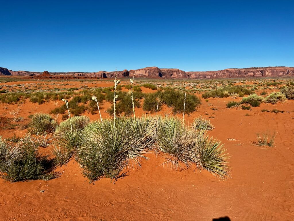
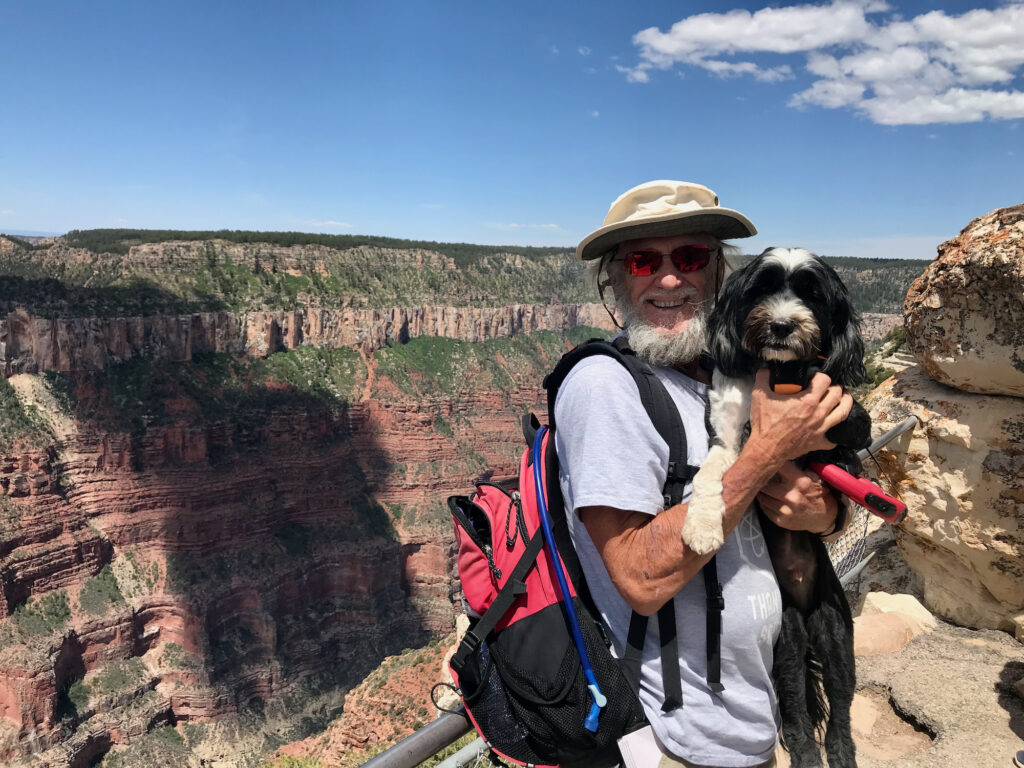
Like nearly all places on the excellent adventure: Greenness. Viriditas. Life from water. Green, red, blue, and every other color on display. Reds that are so bright it doesn’t seem real. Stunning 🤩


That afternoon, I let Jake rest at the trailer and checked out Goulding’s Lodge in town. It was built in the late 1920s and became famous when Hollywood director John Ford began filming there.

Goulding Museum. One room featured photos and other memorabilia from the Western movies shot here over the years.

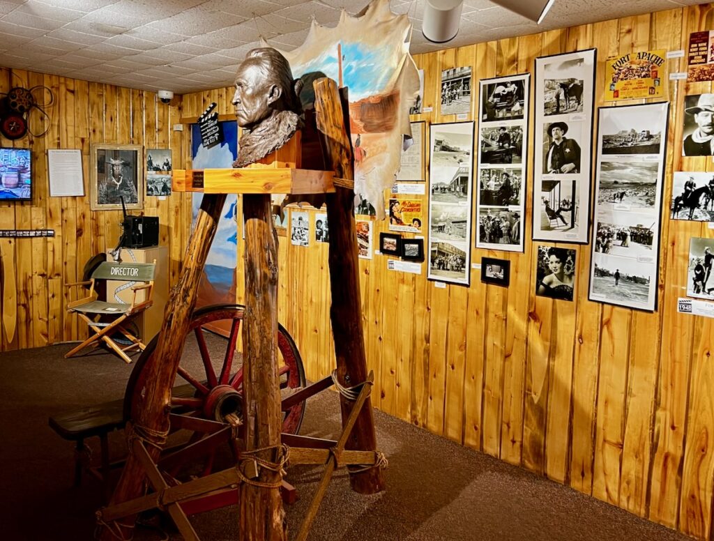
These images from movies by John Wayne, Henry Fonda, and so many others were a big part of my early, impressionable childhood. I wanted to become a cowboy before I wanted to become anything else at an early age.


The following day we watched the sunrise from the other direction. There were some clouds which made for some sunrise color.
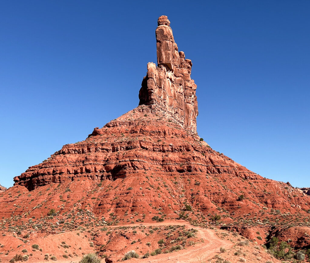
Valley of the Gods

We then packed up again and headed north, the way we came in until we reached the Valley of the Gods entrance. On the trip down the harrowing Moki Dugwash, we came through one side of this valley.

Valley Of The Gods

This road was a bit rougher and steeper than the one on the tribal land. However, I did see motor graders parked strategically at both ends to help keep it clear.

The trip through the valley was incredible. Again, the Starship Excellent Adventure did great – 10% grade in some spots.

Valley Of The Gods

At one point, we passed right by the foot of a butte. Giant boulders scattered at the base. I could imagine them careening down the side of a butte – what a sight that must be!

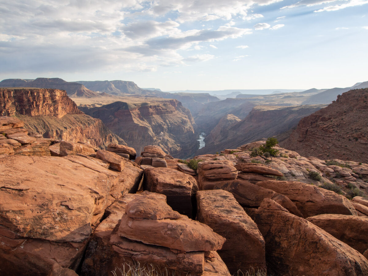
We eventually reach the massive plateau to the north. Ancient giants around me tell me their secrets if I am patient enough to listen. Looking at the strata – I can see an age when this land was covered with water.

Hardened over millennia. Worn away again and thrust upwards by the hot, unrelenting pressure of the fluid earth.

Like all our senses, nowhere near sensitive enough to the ever-so-small changes constantly occurring.

Moki Dugway – you can see a pickup truck with a camper coming down the 10% grade!

We got a good look at the Moki Dugway on the way out. We headed back to camp and relaxed for the rest of the hot day!


We woke on the 4th of July to find a beautiful moonset. The air was so clear you could see some detail on the moon’s surface with a zoom lens.

Moonset over Monument Valley

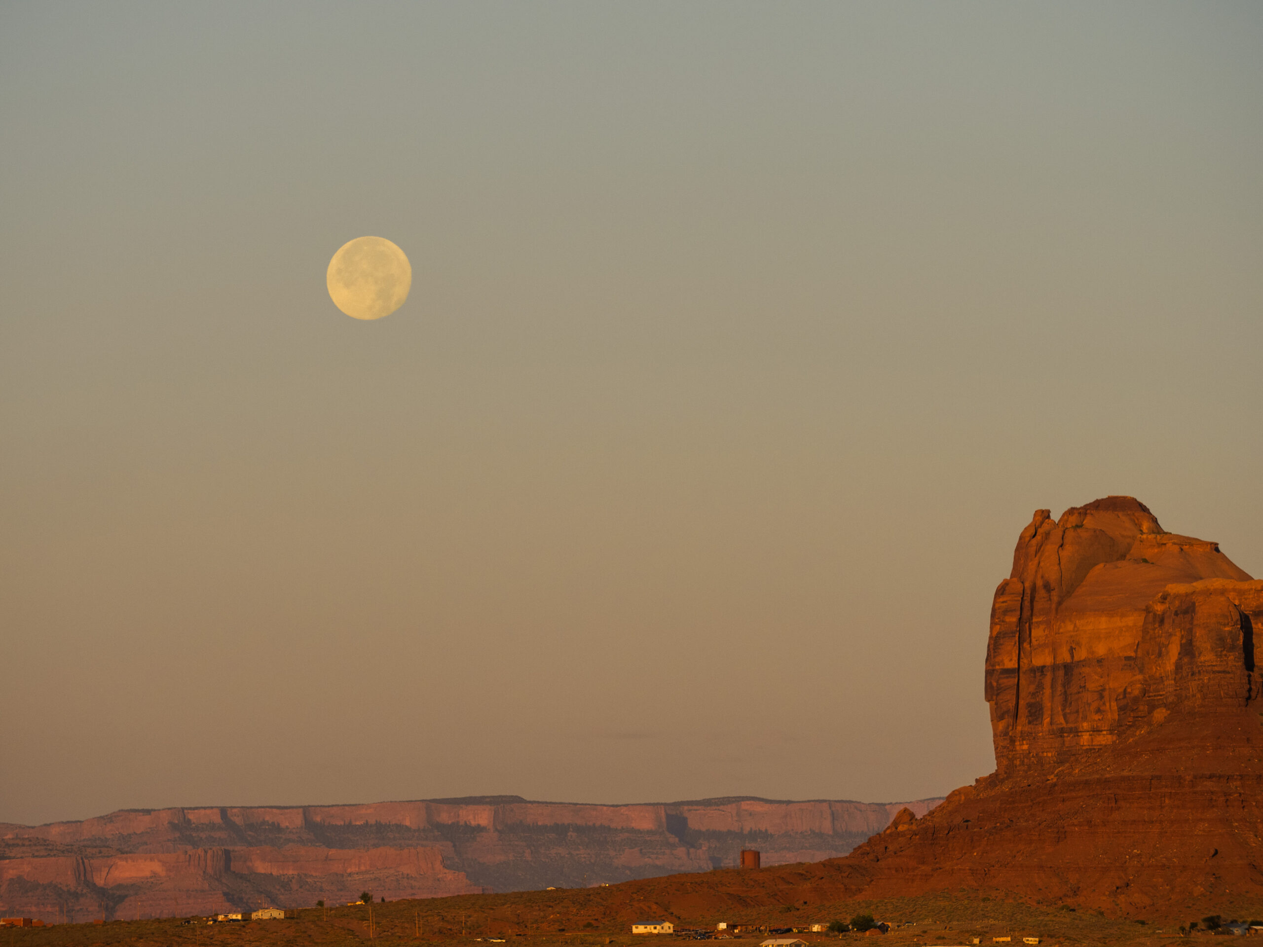
A fitting end to our stay here. Earth and Sky, Sun and Moon. We left this magical place – tall, silent giants watching over the millennia. Waiting to see what happens next!

Next stop in New Mexico for about two weeks before heading back south. The Excellent Adventure continues!

Fade left

We fade from south to west on the second half of the drive.

Leaving on Day 6 from Sonora we drove through the remaining part of the Hill Country into Big Bend Country. The scenery changed pretty radially and it became flatter and dryer. At one point the signs warned of an 80-mile stretch with no services.

His dog riding on the back with his goggles on! They were easily doing 80!

We saw a guy riding a big road bike with his dog strapped to the rear seat. he was wearing a pair of goggles and seemed to be thoroughly enjoying the ride. We passed them several times during the day (which is common – you get to know different rigs, etc). Finally, I was able to get a photo of him as he sped out of a rest area and overtook us at 80 mph!

We arrived in Van Horn and stayed at the Wild West RV Park! Not much to write home about but everything worked and we had a quiet evening there.

Van Horn is home to Jeff Bezos’ Blue Origin launch operations. About 25 miles up the road Jeff and his buddies fly into space on his giant flying dildo 🤣. I suspect many of the people staying in the campground worked there. I doubt very seriously that William Shatner was one of them! I passed on the opportunity to visit. Maybe next time 😎.

We woke to a clear, cold (49 F) morning and headed out on Day 7 for the westernmost end of Texas. We were within range of the Mexican border for most of the drive which took us through El Paso and the New Mexico border. El Paso was not a pretty sight from the roadway – it looked like an endless sprawl in a hot, dry desert.

We stopped for the day at our first KOA Kampground of the trip. We will be staying in them for most of the remainder of the trip. I like the consistency and convenience of going through a single booking process for hundreds of campgrounds. This one was perched on a hill overlooking Las Cruces and Mesilla toward the Guadalupe Mountian range.

We are staying next to the town of Mesilla just north of Las Cruces. The place has an interesting history. It was settled in the mid-1800s. During the Civil War, it was occupied by Confederate soldiers and was named the capital of the Confederate Republic of Arizona for a brief period. Billy the Kid was tried and sentenced to be executed in 1881 here before he escaped (only to be mysteriously shot several months later).

On our way there we stopped by the Rio Grande river at a park near Las Cruces. The riverbed was dry, affording an interesting view of the river, indeed! Jake had a blast running on the sand 🐶.

We started Day 8 out visiting Las Cruces and Mesilla before heading west to Arizona and our next stop outside of Tucson. This called for listening to Linda Ronstadt as we drove through the arid landscape! We came across several stretches of areas with bad dust storms. I am not sure I was encouraged by the roadside instructions!

…and pray there is not some idiot from Texas behind you 🤠

We ended the day in the middle of Tucson’s suburban sprawl in a huge KOA Resort. Resorts are KOA’s mini-theme park with lots of stuff for families and especially kids to do. This one had several hundred spaces and one section was covered (with a solar panel) to protect the spots below from the scorching Arizona sun ☀️. I like them because they generally have a hot tub. Unfortunately, the one here was lukewarm at best. Our spot was excellent though – Jake even had a little spot of grass he could lie in. It was hot but the low humidity and breeze made it feel a lot cooler.

Day 9 and our last overnight before our visit stop at Desert Springs and Joshua Tree National Monument in California. We drove from Tucson northwest and then made a detour to Gila Bend Arizona.

North of Tucson we went through Saguaro National Park and a stunning drive through Saguaro Cactii forests. I was stunned at how green it appeared in some spots like Pacaco Mountain.

Mt Pacacho AZ

Gila Bend Arizona

45 years ago this Summer I was traveling cross country after graduating from college. My finance Margaret and I made a round trip around the US. The last leg of our trip took us the same route I am going now except we were headed to San Diego. We were trying to get back to San Jose to get married and were making time.

Camping outside of Houston I was bitten by a bunch of ants. I had a reaction, took a bunch of Benadryl, and slept for a day. We stopped at Carlsbad Caverns. The next day we went by Alamagordo (without stopping), and made it all the way to Gila Bend. It was the beginning of August and the heat (in our non-air-conditioned Toyota) was almost too much.

Summer 1978 on my way back to California

We were basically out of money. We wanted to stay at the Best Western (now the Space Age In!) but it was too much. We opted instead for the budget strip motel down the road. We paid our money and went to the room only to discover the A/C had not been turned on! It was hotter in the room than it was outside!

Gila Bend AZ – 45 years later

Fortunately, they had a pool that was almost too hot to swim in but gave us a bit of relief. We went to take showers and left the cold water running for what seemed to be 30 minutes. The water never got any colder! Fuck it we said, and pulled the mattress off the bed and threw it in front of the A/C.

Gila Bend AZ – 45 years later

While we were going to sleep we turned the TV on and saw the weather. The hottest place in the United States that day? Gila Bend, Arizona at 117 F!

We woke up at 3 AM with our teeth chattering. While we slept the room cooled down to the point that we were now freezing! As I letter learned, once the sun goes down the desert can get quite chilly!

Gila Bend AZ – 45 years later

The next day driving into San Diego we passed dozens of cars on the side of the road with radiators boiling over as we drove over a mountain pass into San Diego. The temperature seemed like it dropped 50 degrees as we drove down towards the cool Pacific Ocean!


We stopped for the day at Salome Arizona near the Arizona-California border. It was a bit off the Interstate which gave us the chance to see the desert up close! The campgrounds were huge and mostly vacant after the snowbirds headed back north. They had a pool and a hot tub which I thoroughly enjoyed!

Day 10 – last day of our journey west – next stop California!

Toroweap Overlook

Toroweap Overlook is a rustic North Rim scenic area, reached by dirt road, perched 3,000 ft. above the Colorado River

We left later in the day to be there for the late day sun. The access closes at sunset so we left about one hour ahead of time.

The dirt road was very long – the round trip was over 6 hours but well worth it for the stunning views.

Toroweap Selfie
Toroweap Selfie

The cliffs were not for the faint of heart and I made sure I had Jake on the lead whenever we were close to the edge on any of the hikes we take.

We spent several hours there, had dinner and admired the views as the sun sunk ever lower in the west. Towards the end the sun came out in all it’s glory to give us some beautiful views.

We ended getting back close to midnight. Thanks to Dan for the driving! A fantastic day for the excellent adventures of Jake & Eddie 😎🐶!

North Rim of the Grand Canyon

One of the first places to visit on my bucket list

I first visited the south rim of the Grand Canyon in the 90s while living in Colorado. I had always heard the North Rim was quite a bit different than the South and wanted to visit. It was one of the first pins I dropped on my bucket list of places to visit.

Brite Angel Point - North Rim Grand Canyon
Brite Angel Point – North Rim Grand Canyon

It has been over 25 years now and I was not disappointed! Given that the region is in a serious drought I found it to be very green and more in your face than I remember the south rim. We visited the main Visitor Center and hiked the trail out to Bright Angel Point.

North Rim - Grand Canyon National Park
North Rim – Grand Canyon National Park
⁨Bright Angel Point⁩ Panorama
⁨Grand Canyon National Park Panorama

We thoroughly enjoyed the visit – Jake did great given he heat and the crowds!