Sliding Southeast

Having scaled the summit, so to speak, we start our return trip after seven weeks on the road. Our next layover will be in Idaho, where I will visit a museum that was closed on our first trip in 2021. This will take us through the Columbia River Valley, the Blue Mountains, Oregon’s high desert, and then into Idaho.

We left the Seattle area and drove south on I-5 to Portland.

I-5 Portland Bridge

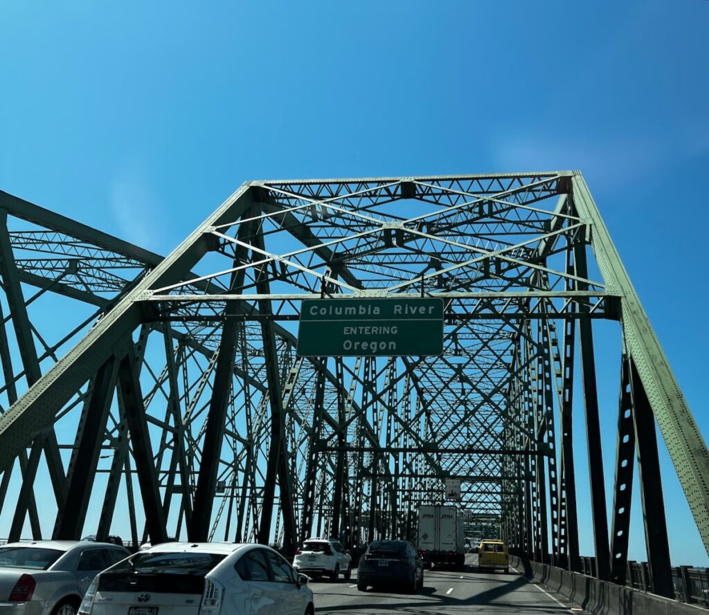
For the next week, we will slowly head south and east on our way to southern Utah. The first segment will take us through the Columbia River Gorge. This would be a new experience.

I could quickly begin to understand the awe of early explorers as I started my drive through the large valley with sheer mountains on either side—a truly majestic feel.


Cascade Locks

We stopped for the night in Cascade Locks. This area features several sights, including the expansive Bonneville Dam complex.

Bonneville Dam Spillway. The two power-generating dams are on either side of the spillway and generate 1.2 GW of electricity.

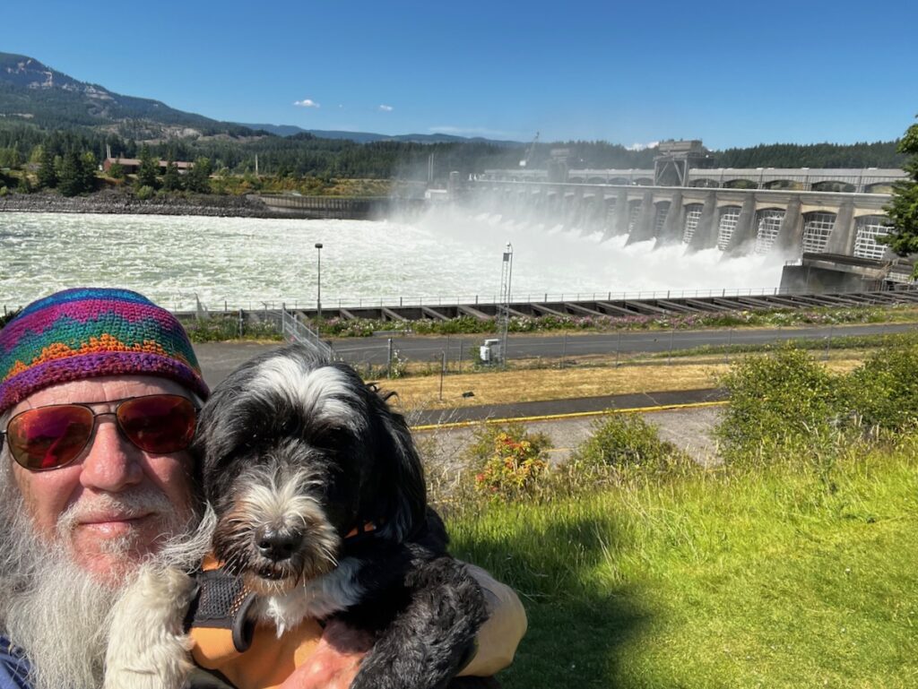
The dam was built in the 1930s. A second power-generating facility was built in the 1970s. A lock on the Oregon side provides up to a 90-foot lift with a maximum length of nearly 700 feet. Awe-inspiring structures!

Cascade Locks

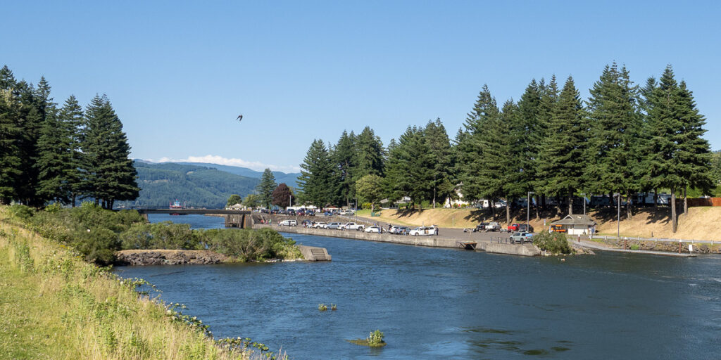
Cascade Locks was a much earlier set of locks located several miles upstream from the dam. They were built in the late 1800s to circumvent the Cascade Rapids. Before the construction of the locks, cargo needed to be portaged 5 miles to avoid the rapids.

Bridge of the Gods

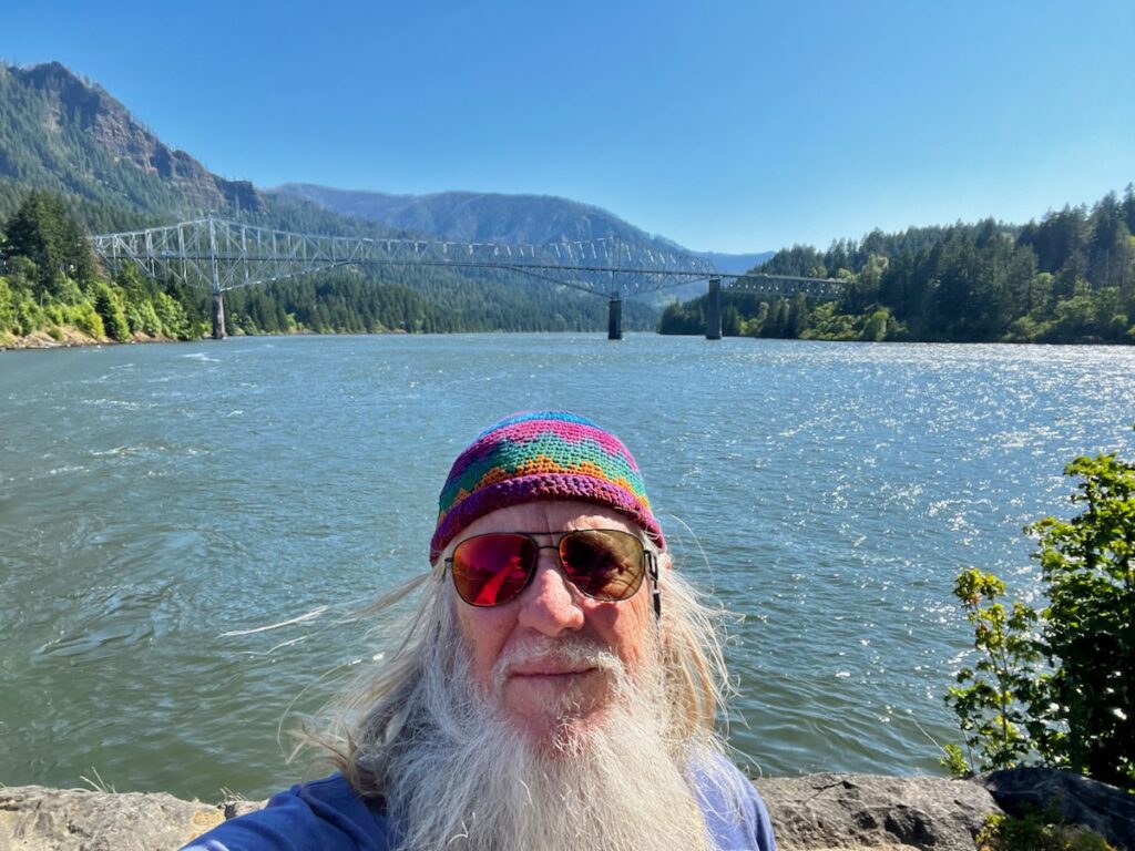
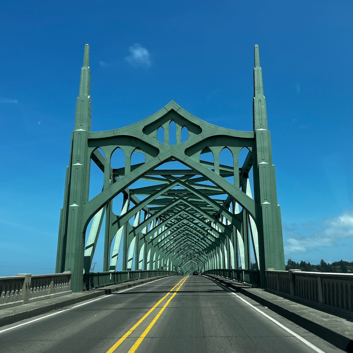
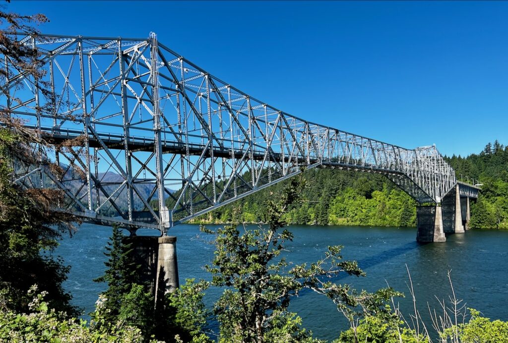
Between the two sits the Bridge of the Gods. An impressive structure, it was built in the 1920s.

We did a hike near the campgrounds on the river. The trail leads us out on a peninsula, offering great views of the river and surrounding mountains—a beautiful spot.

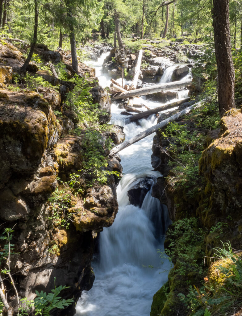
Columbia Gorge Waterfalls

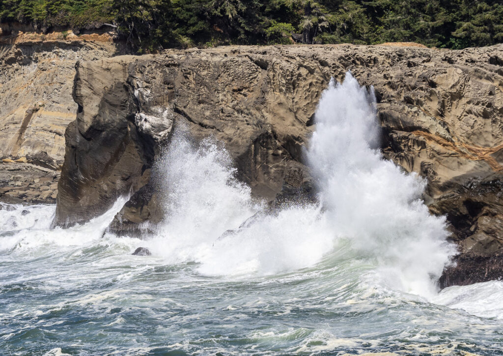
There are six waterfalls in the central part of the gorge. We saw two of them, starting with the best-known of the group Multnomah Falls.

Multnomah Falls slow exposure

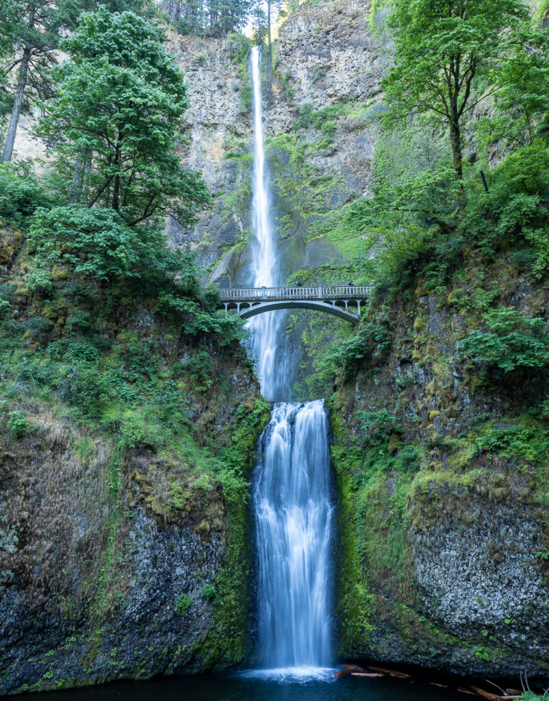
The lighting was perfect, with no shadows—an incredibly picturesque location.

Upper Multnomah Falls

It was a moderately easy walk up to the Bridge.

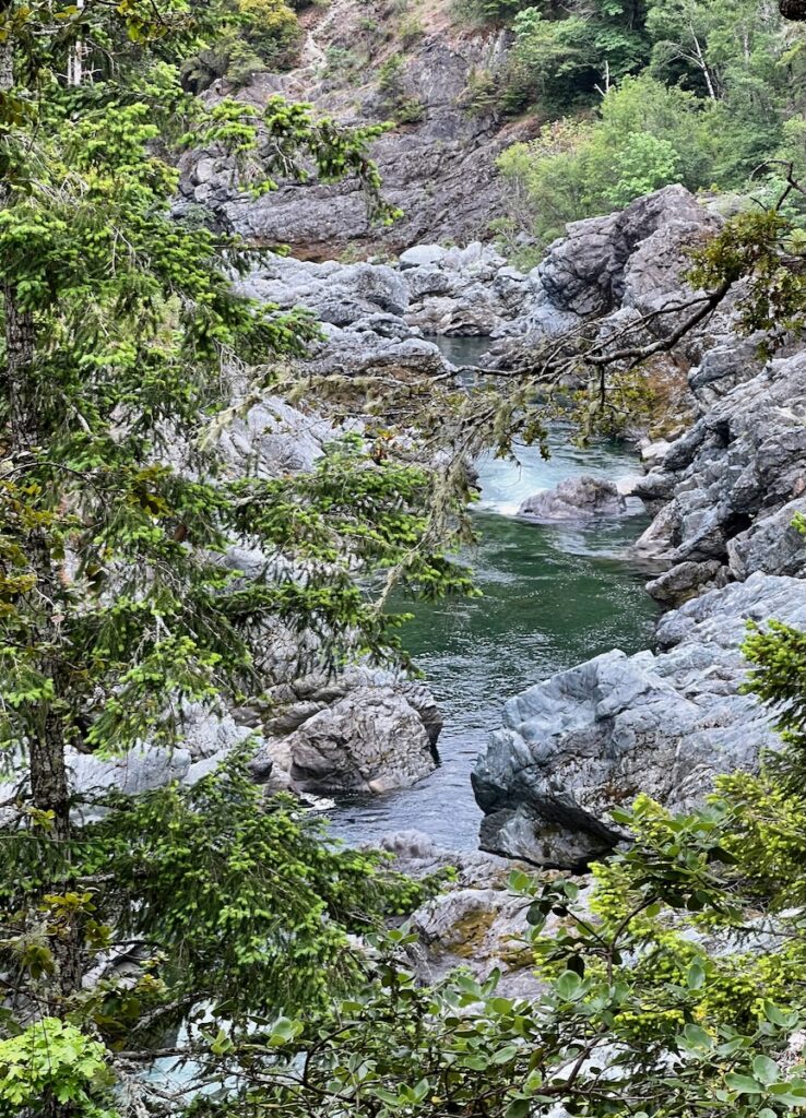
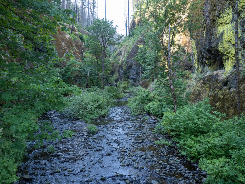
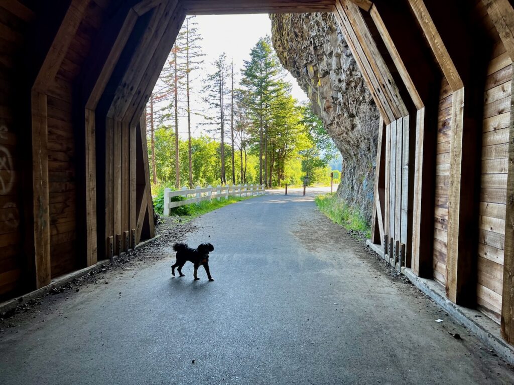
A gorge being formed; Oneonta Gorge was on the old Highway 30. It was a narrow and windy road that rose for a great view of the Columbia Gorge.

Oneonta Gorge along the Columbia River Gorge

There was a tunnel leading from the parking place to the view. Jake saw the light at the end of the tunnel 😳.

⁨Columbia River Gorge

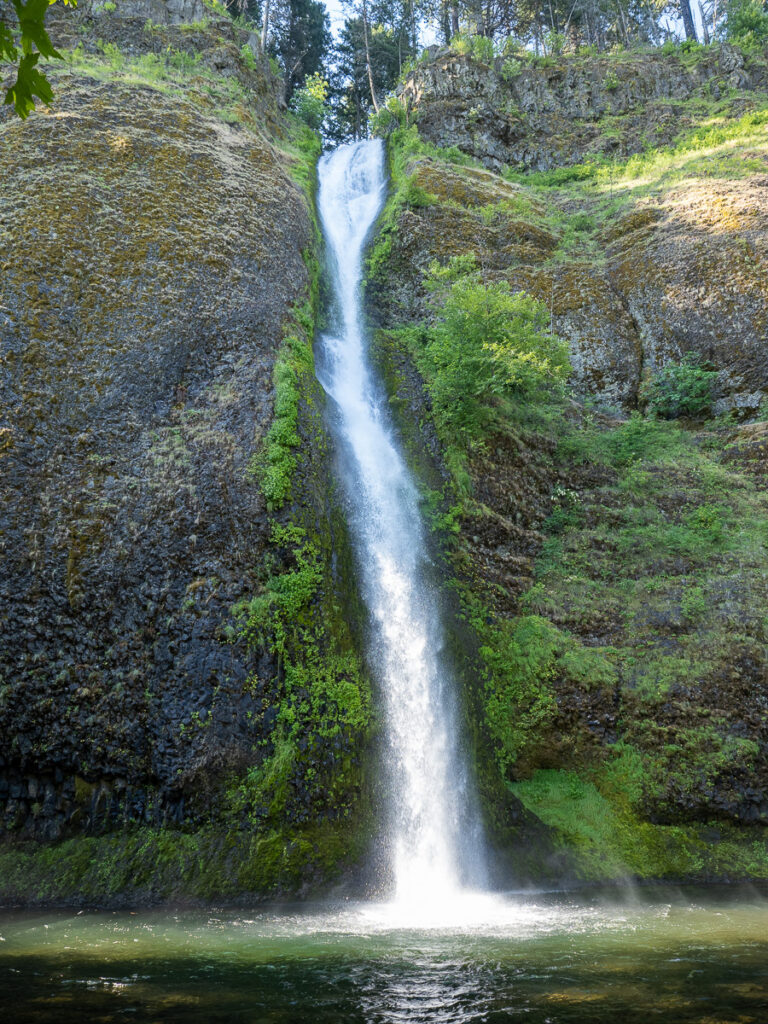
Final stop at Horsetooth Falls before heading back to home base.

Horsetail Falls at Columbia River Gorge

On the way back, we stopped for a shot of the Bridge to the Gods in the morning sun.

Bridge to the Gods

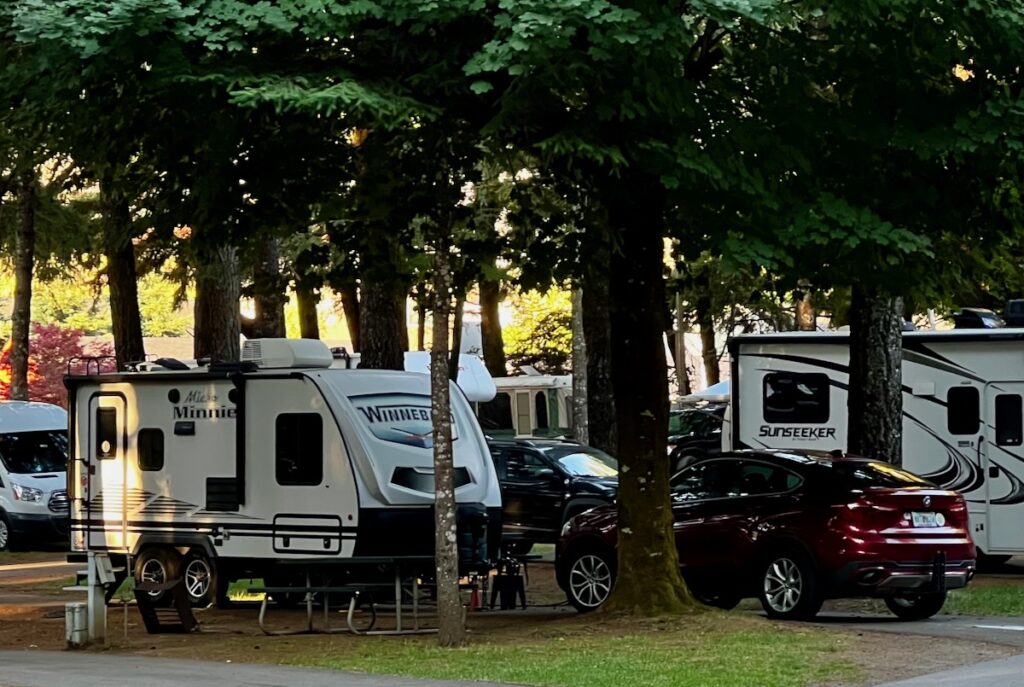
We broke camp late; we didn’t leave until almost 11 AM – a record for us! We enjoyed the stay at the KOA here, a charming, heavily treed campground with a great hot tub!

Cascade Locks KOA

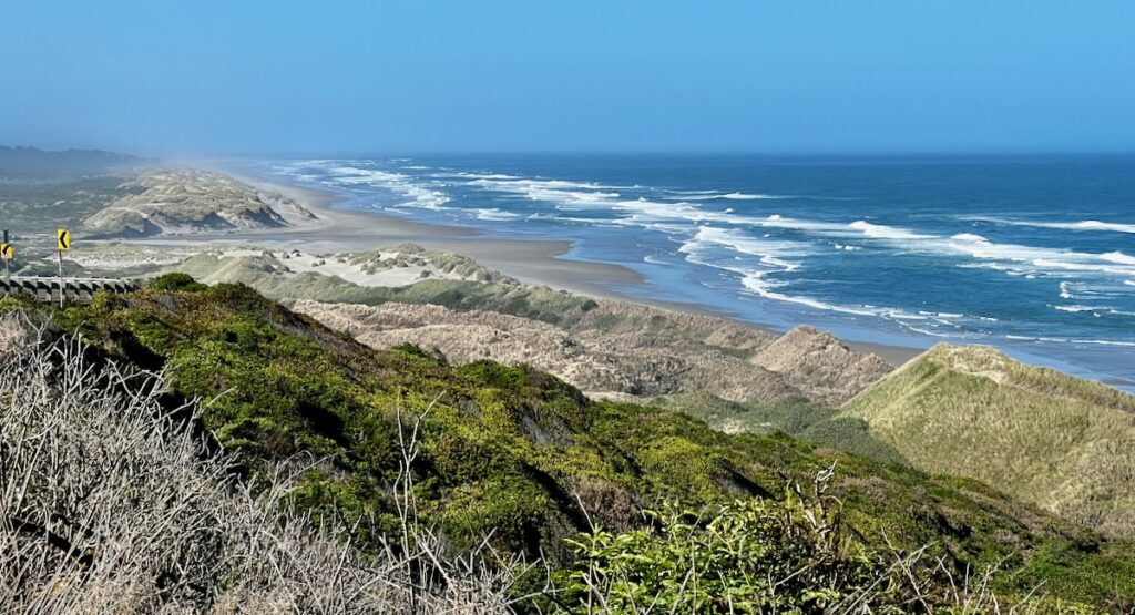
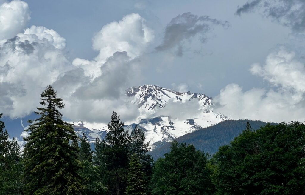
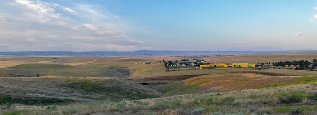
The drive east took us through Hood River and The Dalles. The landscape changed rapidly from forests and granite mountains before becoming a high desert. The visual change for a short three-hour drive was astonishing.

As we drove east, the landscape changed dramatically.

Pendleton

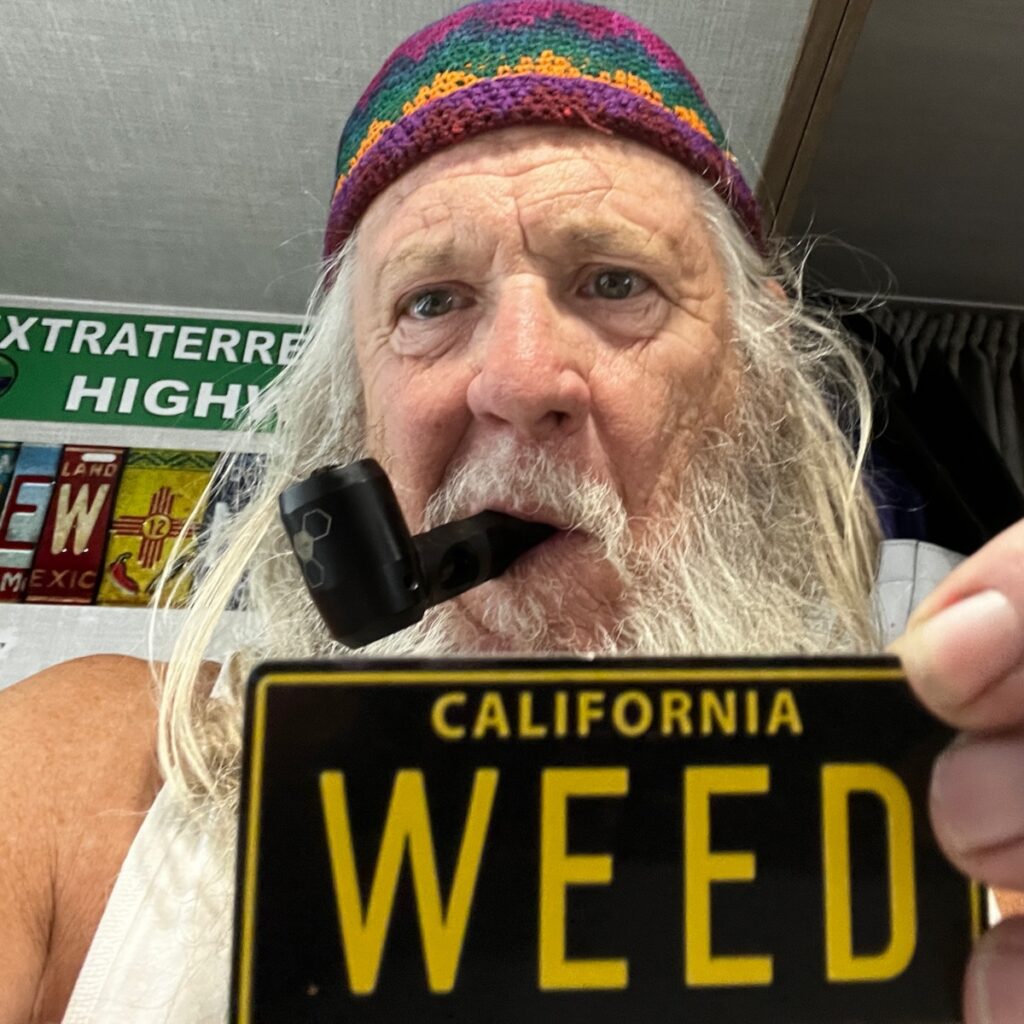
We arrived in Pendleton, and I traveled to the local dispensary. There must have been eight shops in this little town! Without a doubt, Oregon is the hippest state so far for Bud. I wanted to pick up some more fine Oregon herb before leaving the state tomorrow.

I went by a colossal rodeo arena getting there. The budtender told me that Pendelton had the third-largest rodeo in the country every year. Other than that, not much else appeared to be happening!

Pendleton looking south

We left Pendleton and did a very long, steep uphill in the Blue Mountains headed southeast.

Blue Mountains of Northwestern Oregon

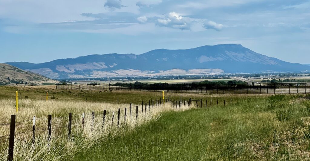
That eventually led into the Snake River valley. From there, along the Payette River to Boise.

Excellent Adventure in Northwestern Oregon

The weather was excellent, and the panorama was beautiful.


Boise

Ex-wife #3 😖

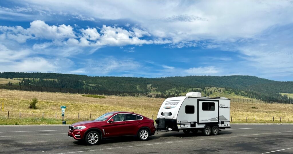
We stopped in an RV Park in Meridian, just south of Boise, for the evening.

I have a history in this area from my looney-tune wife #3. I skied here in late 2013 (her daughter’s wedding), returned home to Atlanta, and decided to divorce her. Her daughters and ex-husband all live here. Bad vibes all the way around.

No sight of anyone, however! We headed outbound for Highway 20. This would lead us along many historic parts of the Oregon Trail.

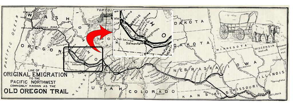
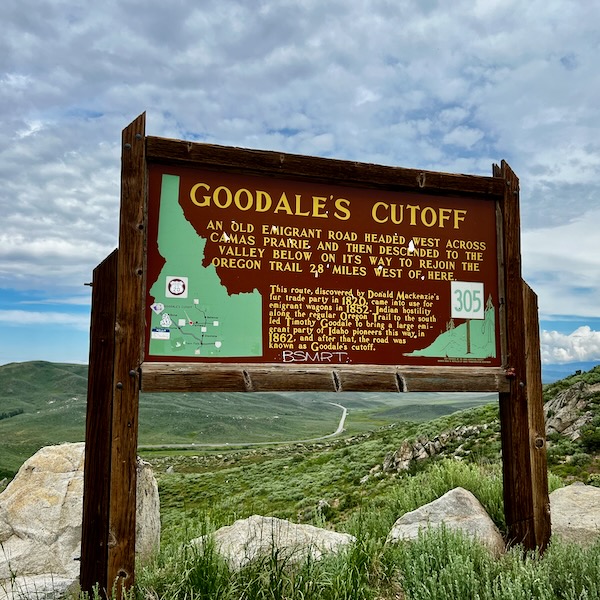
This part of the trail had two routes. The second, called Goodale’s Cutoff, would follow the road we were on. The cutoff became the predominant route after Tim Goodale led a wagon train with over 1000 people over it in 1862.

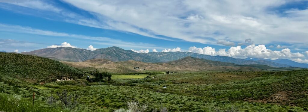
The scenery was beautiful. I could only imagine what early settlers thought when they passed this way 150 years ago. It doesn’t really seem that long ago for some reason. The only thing they had to worry about was if they would survive the journey, no matter what their pronouns were 😬,

I loved winding through the mountains, trying to guess what I would see next. Again, thanks to the winter rain, the views were stunning.

Epic views around every corner!

Craters of the Moon Redux

We first visited Craters of the Moon on our 2021 Excellent Adventure. Two years later, we entered the park from the west.

The landscape was even more beautiful with all the green!
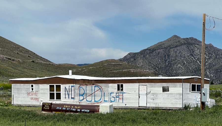

Arco

That brought us to Arco. Apparently, the town has run out of Bud Light. Good thing I don’t drink, but I’ll make sure I Light up an Oregon Bud and toast another visit!

No Bud Light

Tomorrow I visit the EBR-1 Museum. I basically came all this way to do just that.

Bridges & Bozos

After graduating in 1978, I drove to Seattle with my fiance up the coast. She hired on with Weyerhauser – a substantial forest products company, and I was going to graduate school. As part of her relocation package, they paid for us to come up to find a home. As we drove northwards through Oregon, we started seeing these cool bridges.

As a mechanical engineering student, one of the first classes you attend is Statics. The classic problem in statics is how to build a bridge. You spend all quarter learning about all the necessary considerations on how to design something (that does not move) so that it will not break.

So every time we drove through one of these beauties (see above), we would yell: Statics!


We left the Crater Lake area early to get to the coast. The first part was very windy and narrow but otherwise in good shape. It took us through some dense forests in the Southern Cascades. This dropped us into the heart of forest product companies. We passed a considerable mill where the trucks would be hoisted up 50 feet in the air to be unloaded. Amazing.

Eventually, we wound down into Coos Bay. The climate changed radically – the air was sweet with ocean smells and very windy. The town itself seemed very hip – herb dispensaries on every corner.

Oregon Dunes KOA and Dune Buggy Central 😖

This led us to the campground for the night. It was a destination for dune buggy (and tRump) enthusiasts. With the dry gravel, wind whipping, and fucking loud and obnoxious dune buggies fuck all everywhere. Not one of my better picks. Very bad vibe.

Sunset Bay

However, the front desk attendant made a good recommendation for a state park about 15 miles away. The original destination was a botanical garden on the coast just south of the mouth of the bay. Sorry – no dogs allowed 😖! We chose option 2, which offered some excellent photo ops of the coast. This is what I was looking for in California. Fewer trees here!

Lighthouse Overlook

We first stopped at the beach. Jake had a blast, as usual, checking out the new smells.

We then found a parking place for a path that led out to a stunning view of the beach. I got some shots of the enormous waves crashing into the rocks below.

Sunset Bay waves. It’s hard to tell without a good reference, but the cliffs were about 50 feet above the water.

Bozos

When I was in High School, we sat around, got high, and listened to Firesign Theater. They were sort of the National Lampoon of Radio Theater. With classics such as Porgy Tirebiter and Nick Danger: Third Eye, I still listen to them 50 years later.

For some reason, I have always had a powerful association with driving up the Oregon coast that summer, listening to their 1971 recording We’re All Bozos on This Bus.

With classic lines such as:

Mr. President! Mr. President! It’s the cockroaches! They’ve been sleeping with my wife!

Petitioner Clem to an AI version of Richard Nixon

It’s weird, but I think of the other every time I think of one. Too many drugs, I suppose!


It seemed fitting as this place was crawling with Bozos. Stupid people educated by Facebook and Fox News! We got out of Dodge as soon as possible and headed up the coast!

Dunes on Oregon Coast

We had our earliest start – 7 AM – and made a 10-hour journey north. We stopped frequently to enjoy the sights, take a walk or explore the beach.

Heceta Head Lighthouse on Oregon Coast

Several sections of the drive were spectacular, hugging the side of a mountain with shear drops to the Pacific below.

We made the mistake of exploring Connon Beach – not that there is anything wrong with the town except it’s crowded with tourists 🤣 – like me. Except they weren’t pulling an RV! I tried to get out of town only to find the exit inexplicably closed. I had to backtrack through the crowds of cars and people to get back on course!

Cannon Beach on the Oregon Coast

We made it to the RV park after 4 PM. Dozens of volunteers warmly greeted us at this vast and well-featured park.

⁨Astoria / Warrenton / Seaside KOA Resort⁩

Fort Stevens

Early the following day, we drove as far north as possible to Fort Stevens.

The mouth of the Columbia looking towards the Astoria-Megler Bridge (Highway 101)

The sandy beach provided a panoramic view of the mouth of the Columbia River.

The mouth of the Columbia (the Columbia Bar) has the reputation of being the most dangerous crossing in the world, earning it the title Graveyard of the Pacific 🧐.

Looking south from the Jetty

We also made a stop to see The Wreck of the Peter Iredale.

Wreck of the Peter Iredale. The ship ran aground in a 1906 storm.

We were surprised to see a young Elk grazing nearby the road on the way out. In the act of sheer serendipity, my camera was out and ready with the zoom lens! What a handsome young lad!

Young Elk at Fort Stevens

To complete a great morning’s walk, we got another stunning wildlife shot while exploring the wreck.

Eagle is looking for breakfast. I suppose the signs are all up and down the coast to aid in location and search and rescue.

Columbia River Maritime Museum

On the recommendation of my brothers, I paid a visit to the museum in Astoria. As a bonus, a Coast Guard Cutter was making port after being out at sea for an extended period. It was great to see the families waiting for their loved ones.

Columbia River Maritime Museum. The lighthouse ship Columbia served from 1950 to 1979 and served the whole time at a spot 5 miles from the mouth of the Columbia River.

As part of the tour, I visited an old Lighthouse Boat. Named after the river she protected, she was in service for about 40 years before retiring in the early 1960s. I learned in the museum how the entrance to the river earned the name Graveyard of the Pacific. Nearly 200 ships have been lost, including the one I saw in the morning.

Simulation of a rescue at sea by a specialized Coast Guard boat designed to operate in heavy seas

The displays at the museum were first-rate – incredible boats and recreations of daring Coast Guard rescue in unbelievable situations.

Some Ham Radio operators still operate the radio room on the Columbia!

I also stumbled across a fascinating and oddly moving exhibit on the Japanese soldiers in WWII.

In World War II, Japanese soldiers carried a very personal memento into battle: Yosegaki Hinomaru. These flags, covered with signatures and well-wishes for a safe return, were given by family and friends to the soldiers as they were sent off to war. American soldiers in World War II collected flags from the bodies of Japanese combatants to take home as souvenirs. Now, decades later, many veterans and their families are realizing that these flags might be the only tangible evidence of a beloved family member lost in a war fought long ago. Although these Japanese soldiers never saw their families again, their flags are now returning home with the help of a group dedicated to helping bring closure. (from the museum website)

Peace Out


Tomorrow we leave Oregon and head back to my old home state of Washington. The weather forecast says it is supposed to rain while I visit the Hoa Rain Forest. Seems fitting!

Crater Lake

The Summer I moved to California my girlfriend and I made a trip to Seattle. Her cousin got married and she was part of the wedding party.

Eddie & Holly in Seattle, Summer 1975

I had spent the earlier part of the summer diving with a couple of guys that ran a dive shop in Santa Maria. The group of us decided to meet up at Crater Lake on our drive up and go diving there.

We arrived and checked in with the Park Ranger. He told us that only a handful of people had dived there that he knew about. It was a hot, sunny day and we lugged our tanks, full wetsuits, and 40 pounds of weights a mile or so down a trail to the water. The trip back up was worse 🤣.

The water was a brisk 36F and you could see forever! There were large, volcanic boulders strewed around that you could move relatively easily. The only living things I saw were freshwater snails and sparse plant life.

It was an interesting dive to be sure. I am glad we did it because it is prohibited now! They are concerned, probably rightly, that invasive species could be introduced. Being from Florida I know how that can damage an established ecosystem.


Some 48 years later, Jake and I headed out from Crescent City for a relatively short drive to Crater Lake. We mostly backtracked our route, taking time to see the sights on our way.

⁨Six Rivers National Forest⁩ on the Redwood Highway

I stopped for gas along the way and was surprised to see a guy with a gas station attendant’s uniform standing by my window. I figured I got caught in a time warp back to the 60s before he reminded me that in Oregon you can’t pump your own gas! He even cleaned my windshield! I was flummoxed!

We made it to the RV park early. We got some great tips from the staff there for things to see nearby. After lunch and a nap, we headed back out again.

Natural Bridge

I would have named this site Underground River instead. It features a very cool section of the Rogue River that flows underground in an old lava tube.

It was an easy walk down to see the river. You could see where the water comes out and has carved out a cave downstream. It was an interesting, and different, sight.

Mill Creek Falls

The RV park sits across the highway from the small town of Prospect. One of the hikes at the south end of the town took us to Mill Creek Falls. Here, Mill Creek hooks up with the Rogue.

I wondered about the name of the town. I didn’t think there was any precious metal mining in this area. Turns out the residents changed the name in the late 1800s when a railroad was planned to run up the Rogue River. The residents thought it would improve the town’s prospects! Go figure 🤩.


Crater Lake

Suddenly – 48 Years later – Crater Lake

We left at a more reasonable hour to get to the park at 8 AM. We kept waiting to turn the corner (after corner) for the money shot. You pretty much had to park and find a place where the trees didn’t obscure the view – but the combination of blue sky & stunning clouds, really blue water, and the mountain & forest scenery were breathtaking.

Crater Lake & Wizard Island. We took a boat out to Wizard Island when we dove here 48 years ago. There were boulders in the water you could easily move they were so light due to the volcanic nature. And you could see forever…

We arrived early in the season so the drive around the crater rim was not open due to all the snow. There were two spots open at this point, the main area with the Lodge and Discovery Point about a mile counterclockwise.

We spent about two hours taking in the view and shopping for some tasty merch at the Visitor Center. On the way out around 10:30 AM a line was forming to get in. It would be pretty crowded with so little open at this point. I wish we could have seen more, but the memory of my previous encounter was intact! Simply stunning – nothing like it I have ever seen 🤩.

PS – Jake got his first taste of snow. He looked at it funny for a few seconds then it was pretty much like what he was already used to – the beach – just colder!


Rogue River Gorge

On the way back we stopped at the final spot suggested by the camp hosts. Right outside the entrance to Crater Lake is an excellent view of a deep gorge the Rogue River goes through.

Rogue River Gorge. I shot this with a slow shutter speed to emphasize the flowing water. This will definitely make it to the wall at home!

The access that was given to see the gorge was about the best I have ever experienced.

That plus the strong flow of the river made for both beautiful sights as well as sounds. An amazing place and I would highly recommend it.


Crater Lake RV Park

We really enjoyed this campground – It was a mix of seasonal residents and folks like Jake and me. They have a beautiful setting with some nearby walks to the Rogue River. One leads you to a large reservoir with warning signs about water being released at any time. That would have been a sight to see!


Tomorrow we head back for the coast for a drive up the Oregon coast. Our next stop will be in the Coos Bay area.

Volcanos and Redwoods

Our first of two days drive to the northern California Coast took us through the northern Sierra Nevada mountains into Volcano country. Here the Sierra Nevadas end and the Cascade range starts.

Northern Sierra Nevadas near Honey Lake

We passed several large lakes. Because of the heavy run off the water was any other color than blue! The last half of the drive was mostly in thick forests. Many areas had been ravaged by fire.

Honey Lake in the northern Sierra Nevada mountains. All the lakes I saw were very full and looked either gray or brown from the heavy runoff.
Fire-ravaged areas in the Northern Sierra Nevadas

Later in the day, we entered the area around Lassen National Park. Some of the landscape was littered with ejecta from ancient eruptions. It is the southernmost Volcano in the Cascade Range which goes north into Oregon (Crater Lake, Mount Hood) and Washington (Mount St Helens, Rainier, and Baker).

Mount Shasta

Mount Shasta
Weed California

Mount Shasta is a potentially active volcano that lies north of Lassen along I-5 and was our stop for the evening. It is the second-highest peak in California at just over 14 thousand feet. The weather was cloudy and threatening thunderstorms. A highlight in the area is the town of Weed. Full of t-Shirt shops supporting all manner of Marijuana-themed merch! The whole area, like Yosemite, is a destination for people enjoying the outdoors.

We stayed at a KOA that was to the east of Mount Shasta near I-5. Tomorrow will be a shorter drive up through California into Oregon and then drop back down into California along the northern coast.


Our second day began with a photo op of the mountain before disappearing into the clouds. From there it was a spectacular drive north into southern Oregon.

1999 Z3 Coupe. The original owner driving north at the rest area we stopped at. The baby brother to my M Coupe is even more rare. This one had only 43K miles on the clock!

Once at Grant’s Pass, we tacked left onto the famous Redwood Highway US 199. This drive started a long wind down to the coast. The last part was through Rewoods National / State Park.

⁨Redwood Highway 199

It was stunning and whetted my appetite to visit some of the famous groves of these majestic beauties!

Huge tree stump at the Crescent City Redwoods KOA

The campgrounds are very nice and feature a petting zoo – of sorts! Well, they have goats and chickens anyway!

We look forward to exploring the area for the next couple of days.