After three days of traveling, our first stop was in the ‘Cavelands’ of Kentucky. This area north of Bowling Green has more known cave systems than anywhere else in the world 🌎. The largest is Mammoth Caves National Park. The area has a rich history of explorers and entrepreneurs looking for ways to capitalize on Mother Nature. It is also a beautiful horse country with rolling hills of green grass.
Horse Cave
Horse Cave KOA – Glamping, Camping & RVs (for the rest of us)
We stayed about 30 minutes from the national park at a campground in Horse Cave. As the sign says, it features camping and glamping—roughing it in style. They had an assortment of Tee Pees, Tree Houses, Covered Wagons, Cabins, and RV sites. There were lots for kids to do, including a slide and a giant jumping balloon.
I drove into Horse Cave proper to shop and take in the sights. Half the main street was torn up, with no apparent detours. I guess the locals knew how to do it. I found myself in a neighborhood with rotting trailers and large, vicious dogs. I did my shopping and got the heck out of Dodge 🤩.
Mammoth Cave is the most extensive mapped cave system in the world. The geological formations that enable this are a limestone layer (with the caves) underneath a sandstone layer (like a roof). This makes for a very stable formation.
Tourist guide printed in the late 1800s. The caves attracted international attention.
It has a fascinating history dating back over 5,000 years. Native Americans lived in and around the caves where many artifacts, including a mummy, were found!
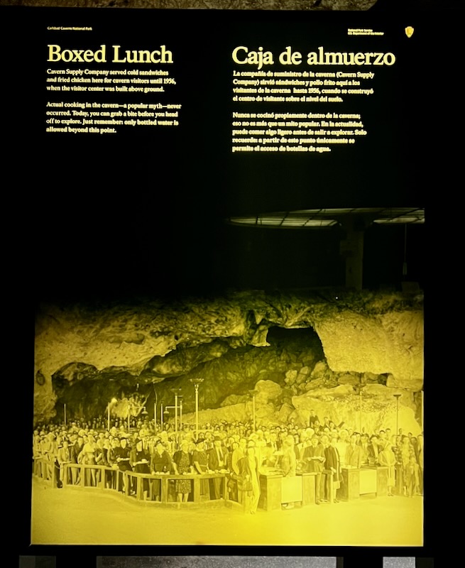
The caves became an international tourist attraction in the 1800s. Ranger Eric told us that tourists from New York came in their Sunday finest to view the muddy caves. Remains of their meals can be found scattered throughout the caves.
In the early 1900s, the infamous “Kentucky Cave Wars’ resulted in shysters and conmen vying for the tourist trade. It seemed locals would go to no length to get the tourist dollars.
The rich Kentuckians decided to take matters into their own hands and prepare the way for it to become a national park. This process was especially contentious because it involved imminent domain. Thousands of people were unhappily relocated. (See the previous post on the Tennessee River Valey—no wonder people in this part of the country distrust the Federal Government.)
It finally became a National Park in the 1940s.
The total distance explored to date is more than 426 miles. The depth of the caves below the surface is between 400 and 800 feet. Explorers in the 1900s were able to determine the likelihood of a cave passage from surface features. These early surveys were hidden from general knowledge for fear of the caves not belonging to the landowners.
I was not disappointed when I embarked on the 4-hour Grand Tour. The tour truly lived up to its name, offering a grand experience of the cave system’s many facets. Ranger Eric’s expertise and engaging, folksy style of explaining the history and formations added a delightful layer to the experience.
A short bus ride leads you to the entrance for the 4-hour tour. The temperatures were cool but not cold, with an ever-so-slight breeze.
Despite my initial concerns about my 69-year-old knees and back, I found the route surprisingly manageable. The well-packed dirt, concrete pathways, and sturdy handrails made the journey a breeze. It was a testament to the cave system’s accessibility, reassuring me that physical limitations need not hinder such a grand adventure.
The first part of the tour winds through a passage created by flowing water.
The journey was indeed challenging, but the well-timed rest stops (two with bathrooms) provided a much-needed respite. The real thrill, however, was in the intriguing cave formations, particularly Boone’s Passageway. Its narrow spots and low ceilings added a unique and thrilling element to the adventure, making it an experience like no other.
The four miles were divided into three segments. The first was relatively open and level. The second took you through a tall and narrow section. The third featured towering staircases and areas where water formed stalagmites.
All in all, it was a stunning but exhausting experience! I felt a bit better meeting Bob at the end of the journey. He’s 80 years old and was my hero for the day!
Friday was a day off for shopping and recovering from the 4-mile walk. I was very sore and desperately missed my hot tub. Tomorrow, we raise anchor and head for St. Louis—Gateway to the West.
After a slight delay due to a major Oh-Shit, the Starship Excellent Adventure launches on the fourth installment of Jake & Eddie’s Excellent Adventure!
First Stop – Krystal
Many years ago, when I was but a pup, there was a Krystal Hamburger store in Cocoa Beach. The Krystal Experience, as I like to call it, is burned into my engrams. Originally, there was a counter where you could order food. Our mailman would eat breakfast there. You see, back in the 1960s, Krystal was well-known for their waffles!
He was a tank driver in the military. He told us how he would file down slugs and use them to buy cigarettes (I tried it later with no luck)! When we had our car accident at Third and Orlando, our car hit his Volkswagen Beetle and pushed it into the storefront of a cafe that was there (no one was hurt). These memories seem like a dream now. Maybe I made the whole thing up!
60+ Years of Krystal
Regardless, I always loved their crappy, grease-soaked hamburgers dripping with onions, mustard, and pickle slices on a square, fluffy white bread roll. If it ain’t broke, don’t fix it ~ indeed. It’s been my tradition when traveling the lower part of Georgia to always get me a sackful! Yum 😋.
Jake’s collection of puppys for the trip! Dino (from 2021) and Red (from 2022). Sluggo (from 2023) not shown. Plus his fav’s Santa Chop!
Cordele ~ Georgia
After a completely uneventful, mind-numbing drive north on I-75, we arrive at our first stop in bumfuck, Georgia. It thunderstormed all afternoon ⛈️.
Cordele Georgia or thereabouts 🤩
We left early, heading towards the dreaded Atlanta, the semi-truck capital of the South. After a short race on the USA’s largest raceway (aka I-285), we headed west on I-20 towards Birmingham. Then we took the backroads through northwestern Georgia, passing through Rome, to finally arrive at our next stop.
Leave It To Beaver
All Hail Mighty Beaver
In the book I recently read, Termination Shock, one of the main characters, T.R., is an oil billionaire who made his money off building enormous gas stations with dozens of pumps and a giant store to help travelers get rid of those cumbersome wads of cash (or more likely debit cards). He repents his sins of contributing to global heating now that his hometown, Houston, quickly going underwater by building a contraption to shoot sulfur into the upper atmosphere to cool the planet down.
All Hail Mighty Beaver. May the Beaver never go hungry! How fucking embarrassing is this stupid sign? For Spaghetti-Monster sake you mindless nitwits!
While this might just be a story, the gas stations are real – and called Buc-ees. Their mascot is a Beaver. Go figure.
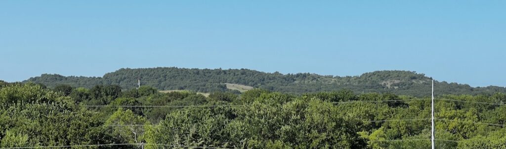
Lookout $$$ Mountain
Lookout Mountain KOA
Our stop for the evening was near Trenton, Georgia. It is a very nice campground secluded in the rolling hills near the Georgia, Alabama, and Tennessee state lines.
Lookout Mountain KOA campground
Lookout Mountain area – beautiful views but hard to find because of all the damn trees 🌲🤣.
We took a frustrating drive through Lookout Mountain, looking for some views of the sunrise the following day. The only good view was on a section of the road up the ridgeway with no places to stop! We finally got to Rock City, expecting to see the views. They are there. They cost $31.
In the morning, we head from Chattanooga towards Nashville and then up to Mammoth Caves.
Tennessee Valley Rest Area – a river that is now a lake.
Whenever I see the Tennessee River reservoirs made during the 1930s by damming the river, I always think of the fantastic Coen Brothers movie Oh Brother Where Art Thou? Over 100,000 people were displaced when the dams were built. In the movie, the valley is flooded right before the trio – Pete, Delmar, and leader Ulysses Everett McGill – are to be hanged, thereby saving the proverbial day! Classic!
Booze It and Lose It in Tennessee!
I generally try to avoid going through the city. My RV safe navigator told me to give it a try. What the hell – what could possibly happen?
Power Lines with Nashville in the background. More crumbling infrastructure. Yee-haw!
I managed to get through with a moderate amount of frustration. One guy honked and gave me a thumbs-up, and another flipped me off for pulling in front of him 😎.
Guns and Ammo – Lots of signs like this. Hell, yes, I need more guns and ammo! Gotta get me a Libtard! Others told me I was going to burn in Hell—more performative warfare on display.
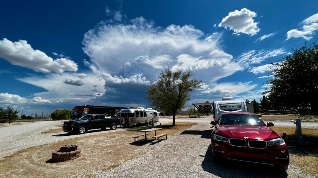
We arrive in the early afternoon. The campground is on the hill overlooking the Interstate on one side and this one on the other:
Horse Cave – looking west
One out of two isn’t bad at all!
Tomorrow: Jake gets to stay home while I explore Mammoth Caves.
35 nights ~ 4600 Miles ~ Mammoth Cave & Natural Hot Springs National Parks ~ Family & Friends
I originally planned to visit Nephew Carl and his family in Wisconsin in 2022. My knee surgery threw a monkey wrench into that plan. We will visit them on this trip, drive through America’s Heartland, and visit some “bucket list” National Parks.
Gradually Northwest to the Heartland
We will start our trip by visiting the Horton family cemeteries in the western part of Virginia. My father’s mother came from early English immigrants who saw the American Revolution and the Civil War. Evidence shows that the family name can be traced to a landowner, Horton, in the 12th Century. They lived near Cumberland Gap – home to Daniel Boone and very early childhood memories of reenactments by the fireside.
We will visit childhood friends who settled on a beautiful TVA reservoir outside Knoxville, Tennessee. We stopped there two years ago on Excellent Adventure 2022.
A tour group gathers in Star Chamber on the Violet City Lantern Tour at Mammoth Cave National Park in Kentucky.
From there, Mammoth Caves National Park (outside Bowling Green, Kentucky) will be our first of two National Park visits.
We then head towards the mighty Mississippi River at St Louis. We’ll stay two nights there before starting the trip north, following the river as best we can, before arriving in La Crosse, Wisconsin. This will take us through Illinois, Iowa, and Wisconsin.
The Heartland
I have always associated the heartland with Scandinavian origins. I spent some time there in the 1980s and loved their style!
We also look forward to seeing nephew Carl, Dr. Kari Bringe, and the “Norwegian to the Core” Bringe Family. They are my perfect vision of America’s Heartland as a multi-generational (successful) farm family.
Clan Tubridy & Clan Bringe – Fall 2021 – La Crosse, Wisconsin
Driving through Minnesota, our next stop will be in North Dakota. We will visit Sister-In-Law Myrha’s brother and sister-in-law in the middle of a wheat field! I met them once many years ago. They are woodworkers, and I would love to see their setup in the Heartland. It also gives me an excuse to drive all the way from the farmland of the Mississippi River valley to the Great Plains before they drop southwards.
The Road to Nowhere
Drive to Nowhere
I saw a route on a map that listed 10 great drives. The Drive to Nowhere was one, following a route just west of our chosen route! They say this is the truest path through America’s Heartland.
It will take five days to reach our next National Park stop, Hot Springs National Park, outside Little Rock. Along the way, we will stop in Sioux City, SD; Omaha, NB; Kansas City, KS; Joplin, MO; and Sallisaw, OK.
Hot Springs National Park, Arkansas.
At the end of this journey, I will complete the milestone of visiting all 50 states at some point in my nearly 70 years on this beautiful planet I have come to love so much. The only state missing was Nebraska! I landed there once to catch another flight, but I don’t count airport only stops!
The Road Home
From there, we wind our way home, stopping in Louisiana, Mississippi, and Alabama before returning to our little beach shack on the ocean.
Despite the heavy rain, we left Memphis and headed for Nashville. An overnight there, and we were on our way to North Carolina.
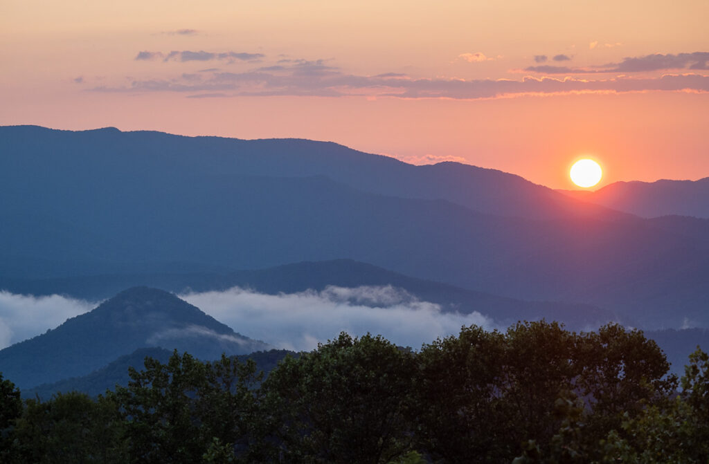
Smokey Mountains near Waynesville and the Blue Ridge Parkway
The drive from Knoxville to Scaly Mountains through the Smokey Mountains was very scenic. We probably stopped at the trip’s most excellent rest stop, near the Blue Ridge Parkway.
Scaly Mountian
Picken’s Nose
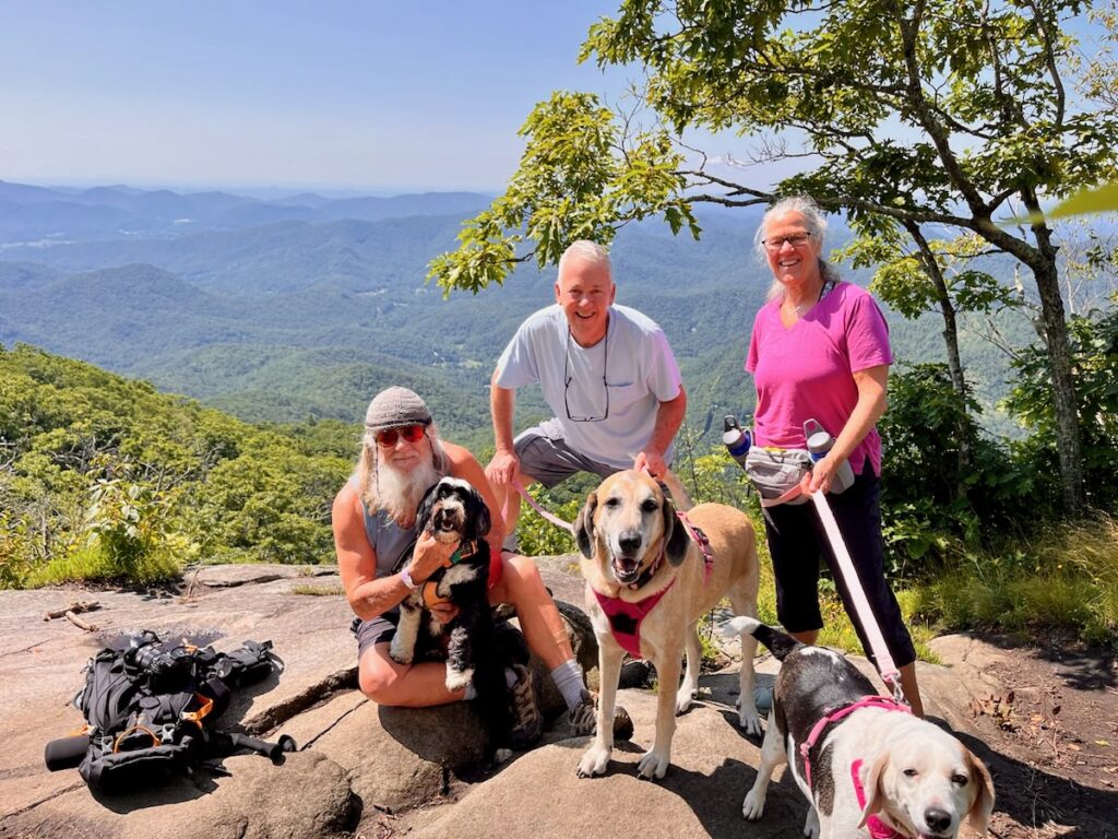
We enjoyed three nights with Dave, Lisa, and the Girls. We got a couple of great hikes in and enjoyed Lisa’s most excellent culinary delights! Jake got to say hi to his cousins Elly and Bonnie. And I finally made it up late enough to see the sunset!
Sunset from Easy Breezy – Dave and Lisa’s magnificent home in the mountains
We had a torrential downpour on the first afternoon! Lightning cracking all around! Poor Elly Mae was not a happy pupper!
The only thing left to do now is make it home. Wow. It’s hard to believe our nearly three months on the road are at an end. What a fantastic time it has been.
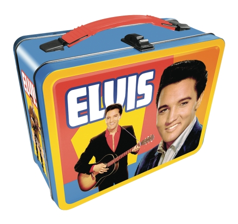
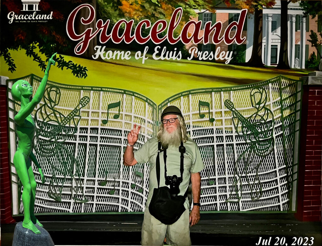
My parents were not fans of Elvis Presley. Although he was only ten years younger than they were, I never heard either one of them express any interest in his music. It was impossible to grow up in the 60s and not know of him. Then in the 70s, he seemed to lose it ala Michael Jackson and Prince.
The one thing I always remembered more than anything about Elvis was Graceland. And the only thing I knew about Graceland was the Jungle Room. Can you even imagine? And apparently, girls were everywhere. A young boy’s fantasies come true!
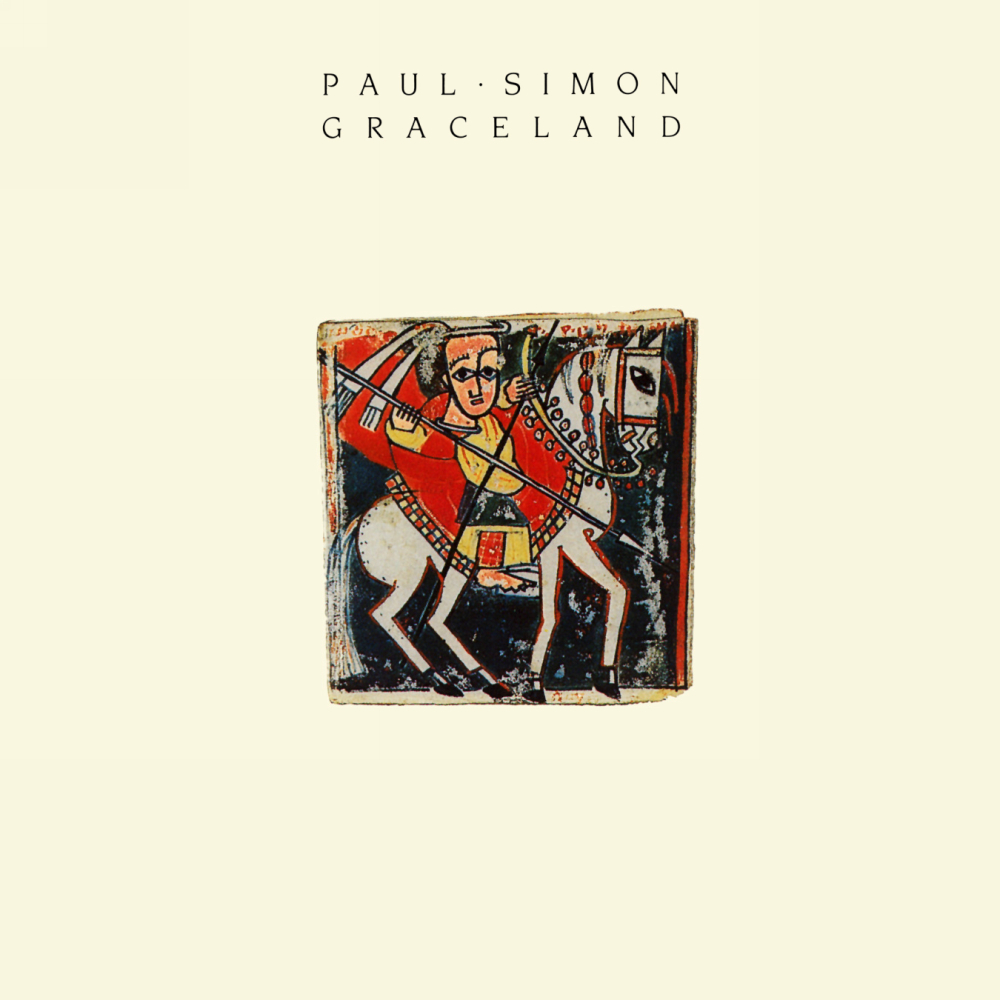
Then Paul Simon came along and made it famous again in the 90s. One of my favorite albums where every song – including this one – is memorable. I guess it was always meant to be that I would make it here one day.
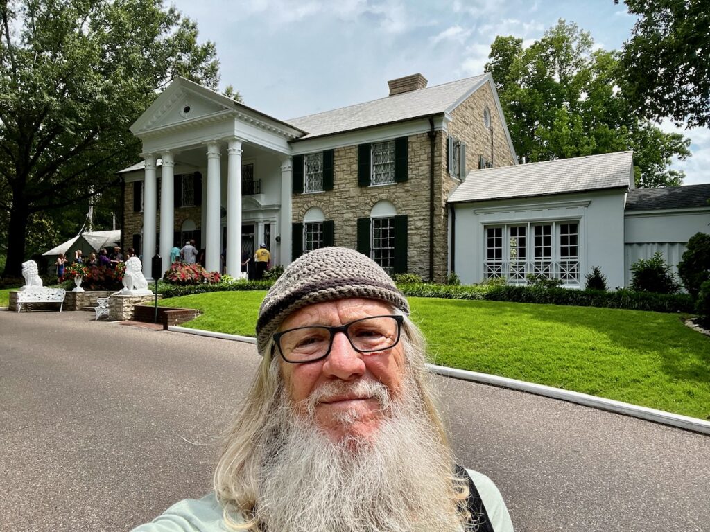
Driving up the parking lot to the entrance was a bit of a disappointment. That’s what Simon’s first impression was. It looked like a giant strip mall. Once inside, I learned the Mansion was across the street. I secured a 10:30 AM tour and toured the museums.
Graceland Museum
When he started to become famous, somebody decided to keep everything he ever had, every photo taken of him – every bit of him. There were about half a dozen significant themes – his toys, movies, and even a tribute to other rockers that acknowledged his greatness (just to keep him relevant!).
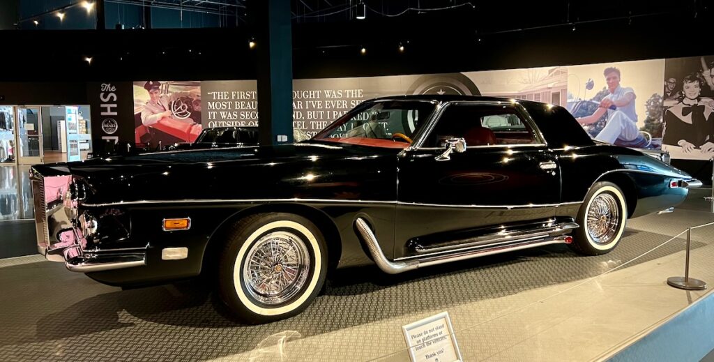
1973 hand-built Stutz Blackhawk. My favorite car on display. The BMW 507 he bought in Germany was sold and ended up back in the hands of BMW in 2014. It was trashed, but they restored it – it’s the most valuable 507 out there!
Between each one was a gift shop nearly the size of the exhibit!
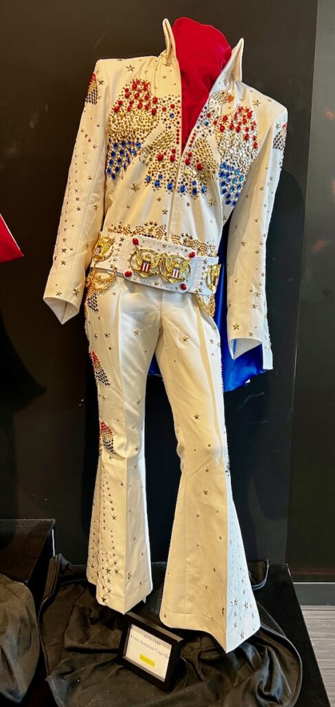
$4,025.00. Elvis not included.
You name it, it was there, including this $4,025 replica of the outfit he wore in his Hawaii special.
Graceland Mansion
The tour lets you walk through the first floor of the mansion. It was stunning – I loved his bohemian style.
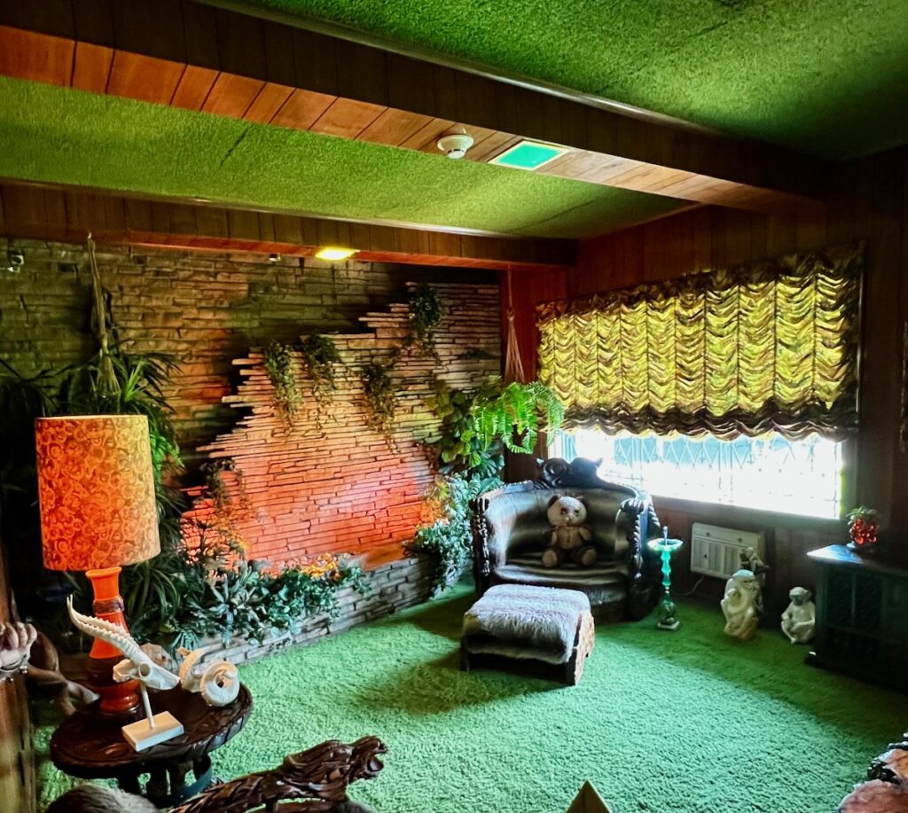
The jungle room. Shag carpet on the walls and ceiling, along with the wooden beams. Very cool at and the stunning wall! But where are all the girls?
Other favorites!
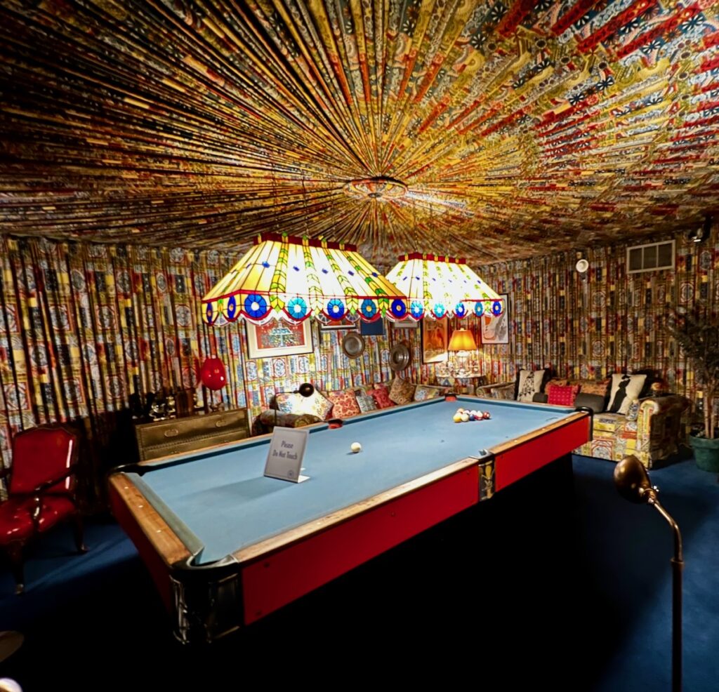
Pool room – Wow!
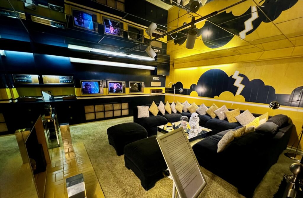
The movie room – Stunning!
The trophy room had more personal stuff of his, like his student discount card. But it was this stuff, like the slot car, that I related to because I played with these growing up.
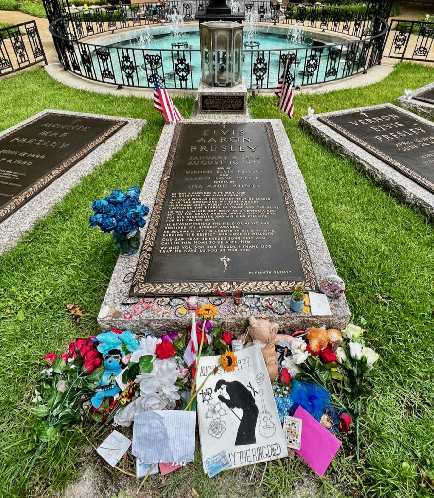
Finally, the pool and meditation garden served as the graves of Elvis and his family. Quite moving.
The King. Dead at 46 – or is he?
I am glad I came. The most expensive thing I’ve done so far on the trip. Not even in the same category as Yosemite or the Redwoods. But it’s a unique piece of Americana.
Graceland
And as the man says: Poor boys and pilgrims with families, And we are going to Graceland.
We woke up the next morning to a downpour with bolts of lightning flying about! Great way to wrap up the tour!
Southaven (Memphis) RV Park in a Thunderstorm
East to Nashville and then to the mountains of North Carolina for a visit to Browns Mountian.
Three days to cross Texas and get to Memphis. Elvis awaits!
We left Carlsbad and drove through the land of the dead oil wells for most of the morning. Very few wells were pumping. In some places, you could see them to the horizon. The towns we went through looked deserted for the most part. Later in the drive, we started hitting the ones that were operating.
Lubbock
We got to the RV Park to discover they had a hot tub! The scenery on the drive into the area left me underwhelmed, as did the stuff I read about Lubbock. So I passed in favor of sitting in the hot tub that afternoon and left early the following day.
Lubbock. I’ll Pass.
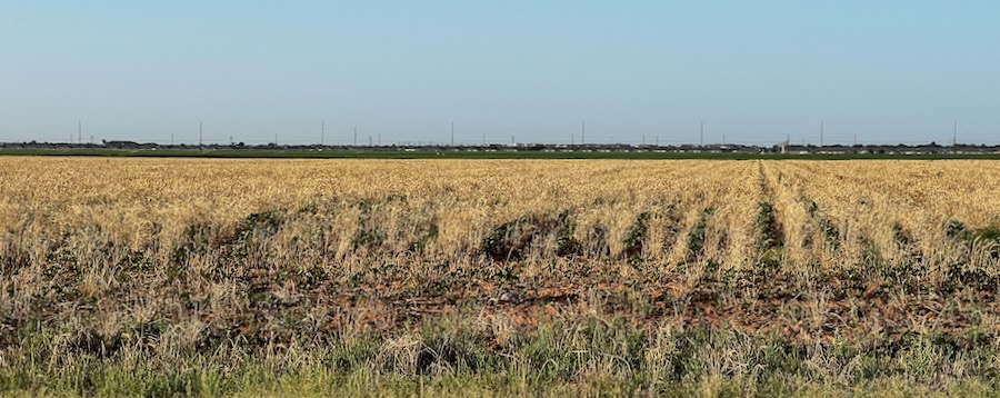
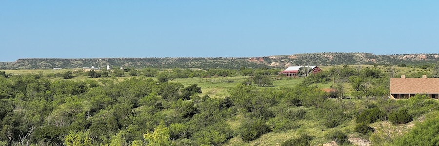
The second day’s drive started in the grasslands. A lot of water, and everything was green as usual. Eventually, I got into some very pretty hills with smaller mesas and buttes off in the distance.
White River
The were a lot of large cattle ranches with cool names. That leads into Wichita Falls through several large wind farms. I love driving through these monsters!
I discovered you can see a map of all installations in the US. On average, a single turbine can power about 1000 homes. Blades are about 100 feet long.
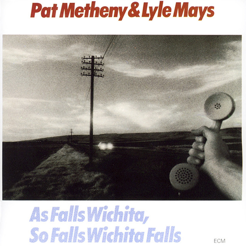
I listened to Pat Metheny and Lyle Mays As Falls Wichita, So Falls Wichita Falls on the way in. It was the number-one Jazz LP in 1981. I love It’s For You – the perfect nostalgia song.
They were so young, and their music was so fresh. I started listening to them in the late 1970s. Now, Pat is my age, has three kids still in school, and tours all the time. Probably the most successful jazz guitarist ever. Lyle died early several years ago after stepping back from music to become an IT consultant. And here I am 40+ years later – finally there 😎.
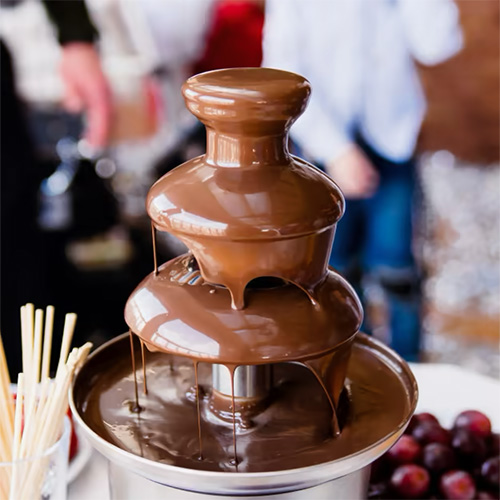
Wichita Falls
It turns out the original falls that the city was named after were destroyed in a flood in the early 1800s. It wasn’t until the 1980s that another one was built. They pump river water out to make it work.
I have to say I was a little disappointed when I saw it. Like the fountain in your backyard – only bigger 🤣. It looks like a giant chocolate fountain to me 🤩. Slightly more brown than my toxic waste spill in New Mexico 🤮.
The Chamber of Commerce must be proud – you can see it from the fucking freeway. So Falls Wichita Falls – indeed!
Back on the road. Lots of cattle ranches. Lots of trucks too. I got the impression there are a lot of second homes for the urban folks here. Primarily it was just grazing farmland. They have a lot of pull-outs with picnic tables which make for nice places to stop.
Northeast Texas
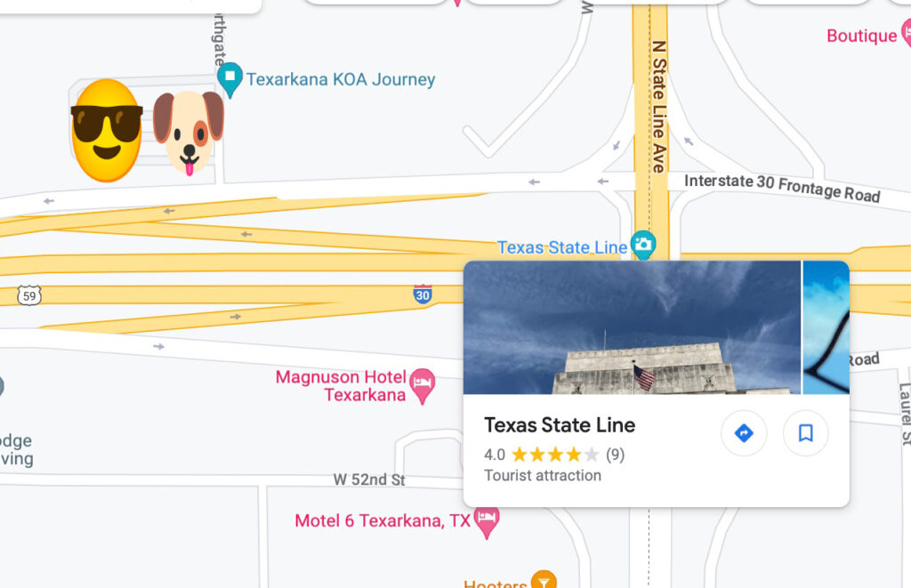
Texarkana
This is one end of a train line established in 1874 originating in St Louis. It has twin cities in Texas and Arkansas. We are just barely on the Texas side.
Texas Arkansas State Line. Not much to do around here, so it’s a tourist attraction. Rated 4 Stars!
The state line runs right down the middle of the fucking freeway here. There is a sign somewhere. It’s rated a 4-star tourist attraction on Google!
I’ll pass again and get an early start. It will be good to get out of Texas again. Bad vibes all around for the most part, although I didn’t see too much of the Fuck Biden stuff on this leg of the trip.
So here we go!
I’m going to Graceland For reasons I cannot explain There’s some part of me wants to see Graceland And I may be obliged to defend Every love, every ending Or maybe there’s no obligations now Maybe I’ve a reason to believe We all will be received In Graceland
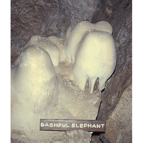
Last stop of the New Mexico portion of the journey before heading home. I visited Carlsbad in 1978 on my gross country trip before graduate school. I remember it was a welcome relief to the hot weather I had been traveling through! And the Bashful Elephant.
The drive from Roswell was short, hot, and flat. We passed through the biggest dairy farm I had ever seen – the were thousands of cows, and the stench nearly gave me a headache! We arrived and watched an enormous thunderhead threaten us with rain.
Carlsbad KOA
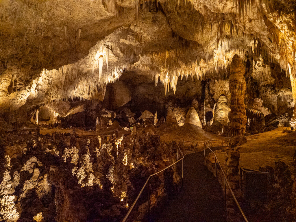
Carlsbad Caverns
I made a reservation for an 8:30 AM tour. Jake got to stay home this morning. Interestingly, the park has a kennel – the first I have seen so far on our journeys. The drive took me about an hour. The canyon leading to the caves was very scenic.
Carlsbad Caverns
The caverns were initially explored around 1900. Local ranchers used to collect the batshit (aka guano) for fertilizer. Eventually, it was turned into a National Park. Elevators were installed in the 1950s, and Rangers would lead tour groups through the caverns. The elevator shaft was one of the tallest at the time, going some 750 feet down. You can also hike the original entrance, adding about 1 1/2 hours each way.
One person on my trip commented it was the most fantastic thing they had ever seen. I felt the same level of awe that I did when visiting the Redwoods earlier in the trip.
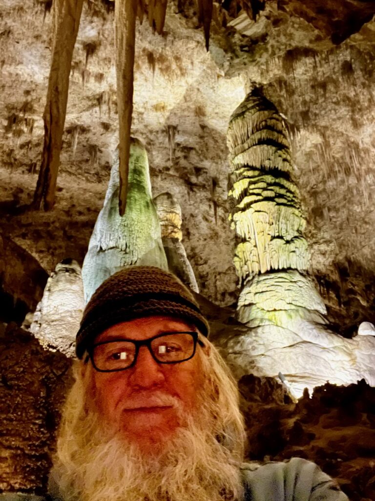
It was an epic experience, with every turn opening up to a more incredible vista than the last. I applauded the lighting design – it really made the caverns come alive.
The whole loop took me about 1 1/2 hours. One of the highlights of the trip!
Alas – the Bashfull Elephant was nowhere to be found.
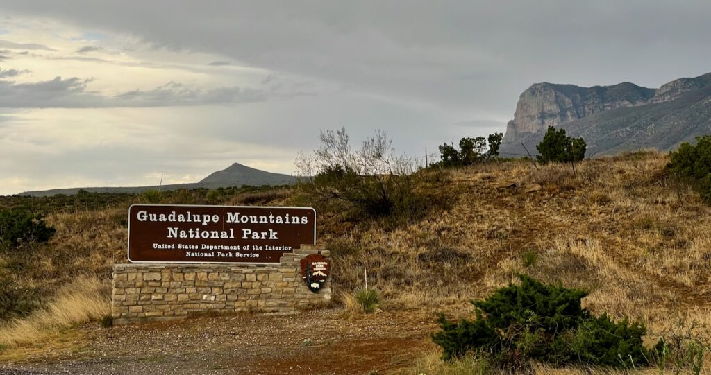
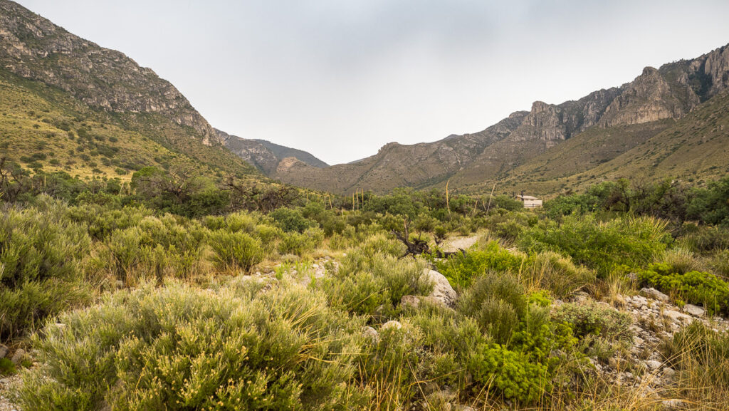
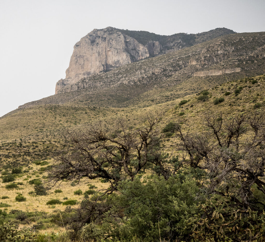
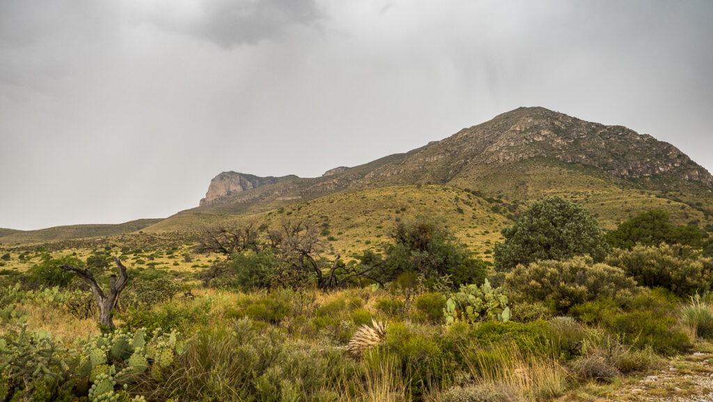
Guadalupe Mountains National Park
This was our last stop on the Big Kahuna as originally planned. This came on the list later in the trip after seeing the mountain range from Las Cruces some two months earlier!
Guadalupe Mountains National Park
I knew there was not much there to see – but hey – it is a National Park. As an official National Park Geek Club member, I needed to check it off my list! And wouldn’t you know – it was the only stop where it rained the whole time we were there.
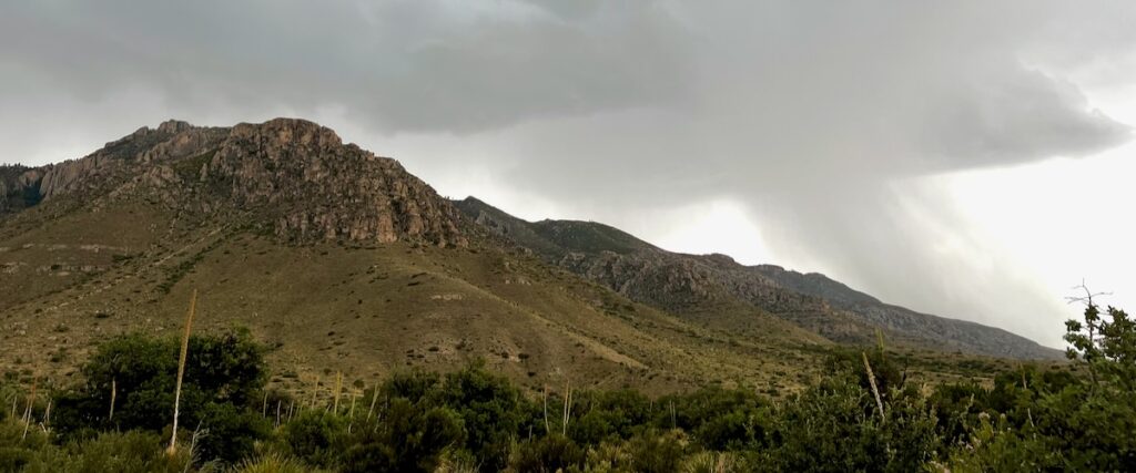
We learned that this whole mountain range, including Carlsbad Caverns, was, at one point in time, a vast ocean reef. They call these fossil mountains because they are built on ancient sea creatures’ fossils. Amazing!
It was actually quite cool – cooling, that is! We managed to get on a quick hike and watch the thunderstorm! I tried to get some shots with lighting – but the weather just wouldn’t cooperate. Hah 🤣!
Thunderstorm on the desert mountains! Magnificent!
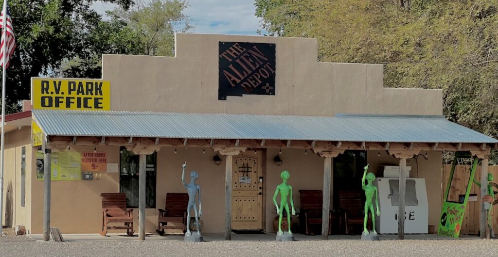
We left the Trinity site with a new mission – to find all the Little Green Men in Roswell I have always heard about. We didn’t need to look far.
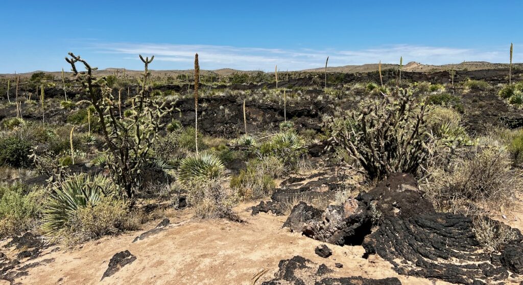
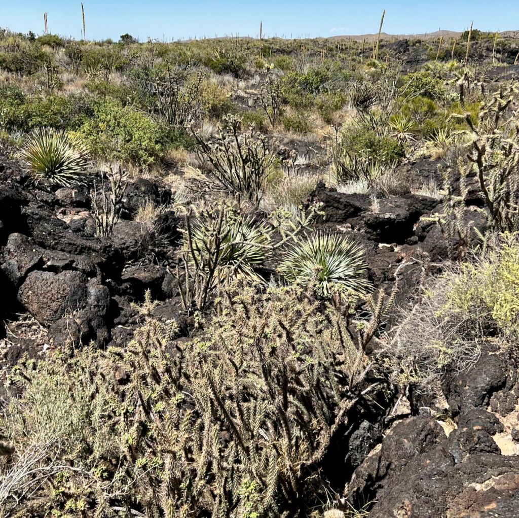
Valley of Fire
First, we crossed over the Valley of Fire again. We saw this in 2021 on a different road to Kanab, Arizona.
It was alive with blooming Dasylirion wheeleri as far as the eye could see. Situated in the lava flows, it made for a spectacular sight!
Valley of Fire
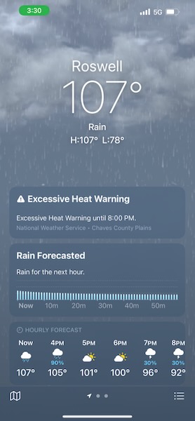
As we continued eastward that morning, it got hot. Really hot. By the time we reached Roswell, it was 107F outside. The trailer tires reached 113F. We got there and tried to beat the heat. Not much fun walking Jake in that heat with little shade to be found in the New Mexico desert.
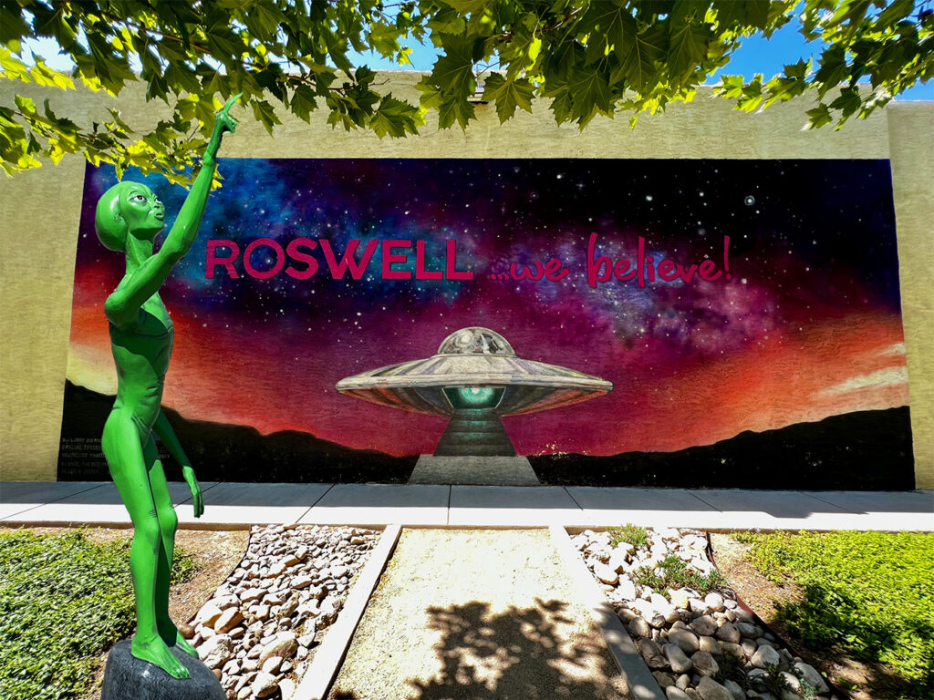
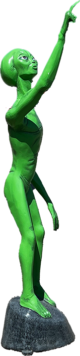
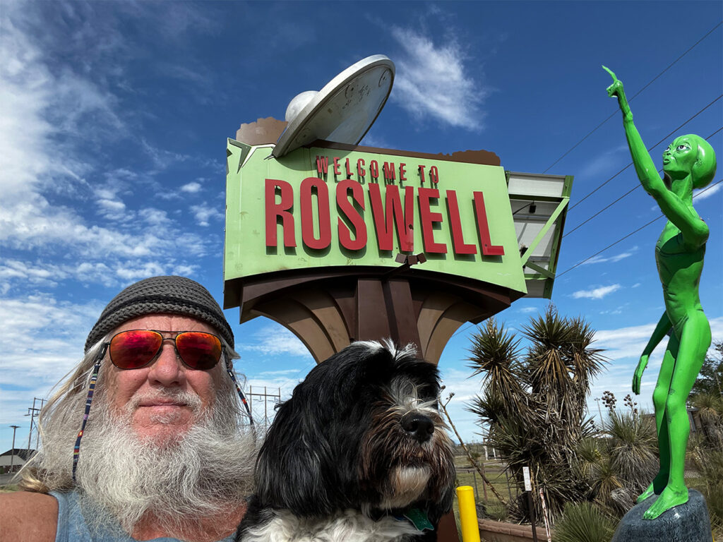
Roswell
Roswell, New Mexico – Epicenter of the UFO movement
The story goes something like this: In 1947, an alien spaceship explodes north of Roswell. A bunch of people see it. A fewer number of people find the wreckage of the flying saucer. Four aliens were dead, but one survived. They examined him. They covered it up because – WFT – a flying saucer? We thought World War II was bad wait for this! Or something like that 😉.
Introduction to the exhibits. We believe!
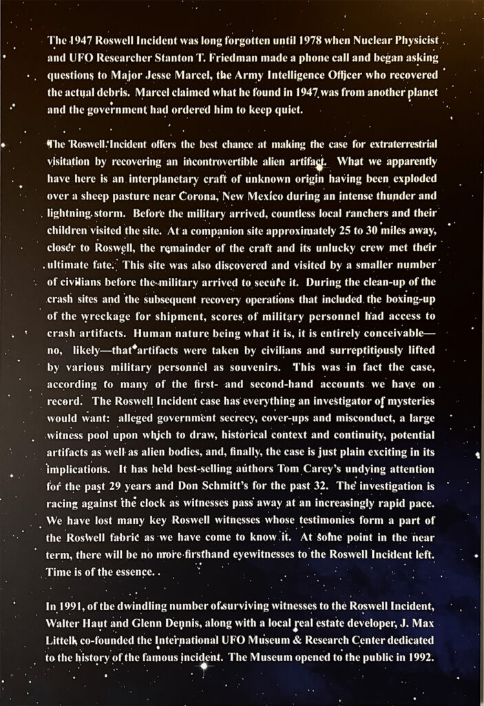
Years later, people started talking. Military people. Townspeople. A cover-up had occurred. The gig was up. They eventually built this museum and laid the whole thing out for the world to see. They host conventions and have regular speakers. They have a research library containing all their reference materials.
We believe.
International UFO Museum & Research Center
There were a lot of people who ended up saying they knew about it. Probably more surprising was the cohesiveness or the individual stories taken as a whole. Many were deathbed confessions! How dramatic is that? Everyone’s 15 minutes of fame? Hard to know.
The surviving alien – bound for the autopsy table!
The second part of the museum had artifacts, including some very cool re-enactments of the alien autopsy—another group of exhibits talked about other sightings, some from antiquity. Intriguing stuff.
The museum was fun and about what I expected. They make a compelling case with all of this evidence. I personally do not believe it – the physics just make it all too unlikely.
I have no doubt that there are – or have been over time – many solar systems that support life. Life is too tenacious and found at all extremes on Earth. Essential ingredients are floating around in interstellar space. I am sure that intelligent civilizations like ours have existed.
The Universe, however, is really big, and physics – especially the speed of light/information – is limiting. 13 billion years old is a long time, and 48.5 billion lightyears wide is a long time to receive and transmit. How weak would the signal be so far away? Space, after all, is not empty.
Or maybe they are just fucking with us 👽. I do believe that another independently evolved species would not necessarily be like those that evolved on Earth—too many variables.
Roswell itself was bigger than I expected. The cashier at the museum told me the primary industry is dairy farming. They grow grass in the fields to feed the dairy cattle.
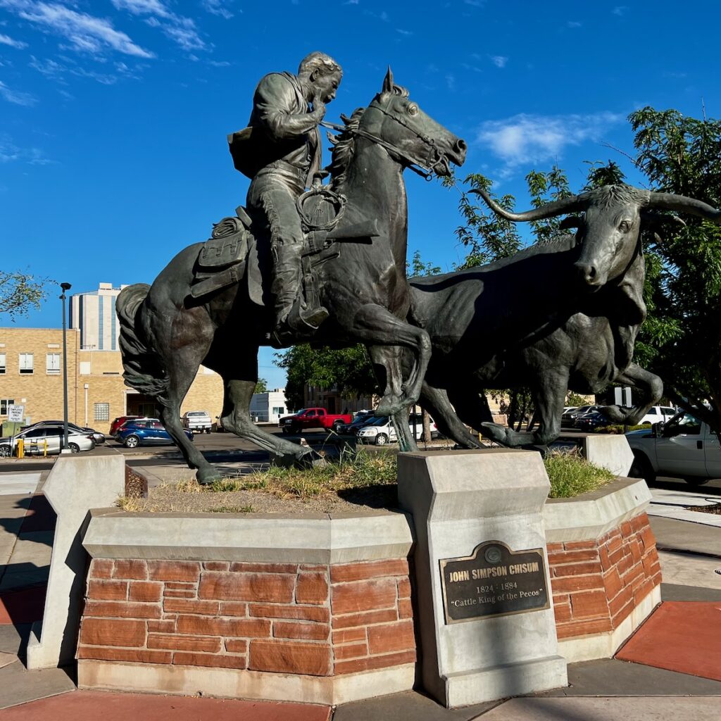
John Chisum – a Cattle Barron in the late 1800s, had his famous Jinglebob Ranch just outside Roswell.
The town does have a grand history of cattle ranching. The statue of John Chisum across from City Hall is a testimony to that. He was a real-life Cattle Barron with over 100,000 head of a longhorn steer at one point in the late 1800s.
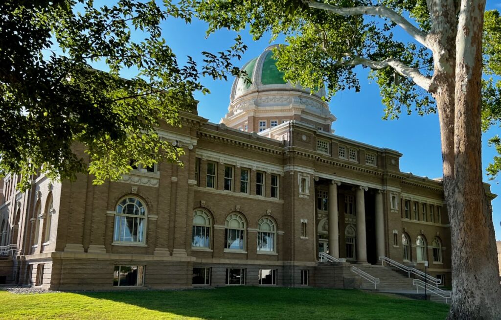
Downtown Roswell
Starting in the 1930s, Robert Goddard set up a secret lab nearby and conducted dozens of launches to test rocket engine designs. During and after WWII, Walker Airforce Base became a crucial player in nuclear deterrence. It was eventually closed.
I was surprised that the whole alien thing was not overdone. Roswell is a bigger city than I expected – the fifth largest in New Mexico. The Mcdonalds’ seems to be the biggest alien attraction other than the museum. They light it up at night!
To my great surprise, it rained that afternoon. This was the first solid rain we had experienced on the whole trip. And it happens when it’s 107F outside! I am surprised it didn’t boil on the gravel as it splashed down! It cooled it off a bit – it was a mere 100F an hour later!
The next stop is our last in New Mexico, Carlsbad. We are staying at a big family-oriented park north of town. I made reservations to see the caverns early Friday morning. It’s supposed to be 107F today and then cool off a couple of degrees for the weekend 🥵. I plan on visiting Guadalupe National Park on Saturday.
Hundreds of years ago, in this area, the native peoples drew symbols on the rocks inspired by their understanding of the natural world around them. Some of these symbols survived; you can see them in a National Park outside of Albuquerque.
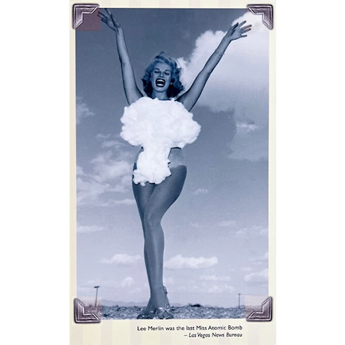
None of them looked like Miss Atomic Bomb above. These were simpler times 🤣.
In the 1950s, when my Dad was testing rockets in Alamogordo, something far more interesting was happening in Los Alamos to the north of Albuquerque.
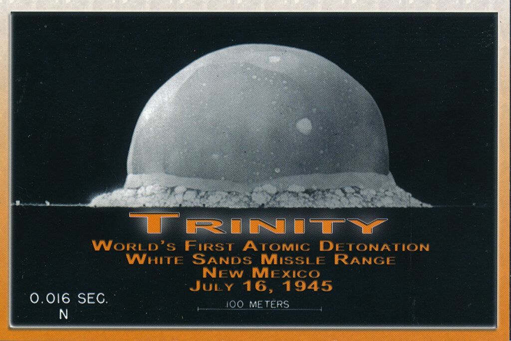
A decade earlier, the most important device in all the history of bipedal apes with big craniums was built and successfully tested. It was called the Gadget. It was tested at a site called Trinity, about 100 miles south of here.
Replica of the Gadget at the National Museum of Nuclear Science and History in Albuquerque
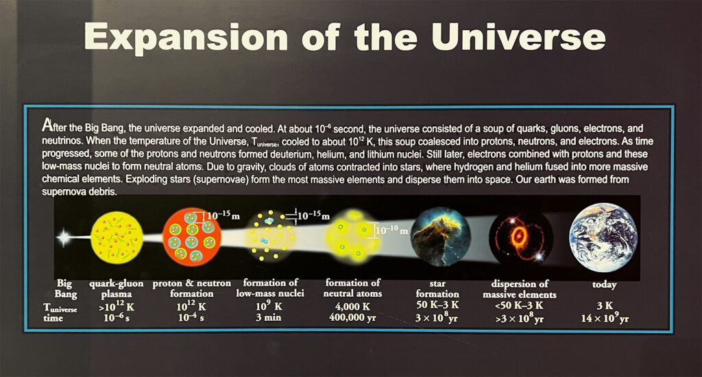
The successful test of the first Atomic Bomb in 1945 changed everything. It was the culmination of an evolution of the understanding of our Universe unparalleled to that point. Our new understanding of the natural world around us.
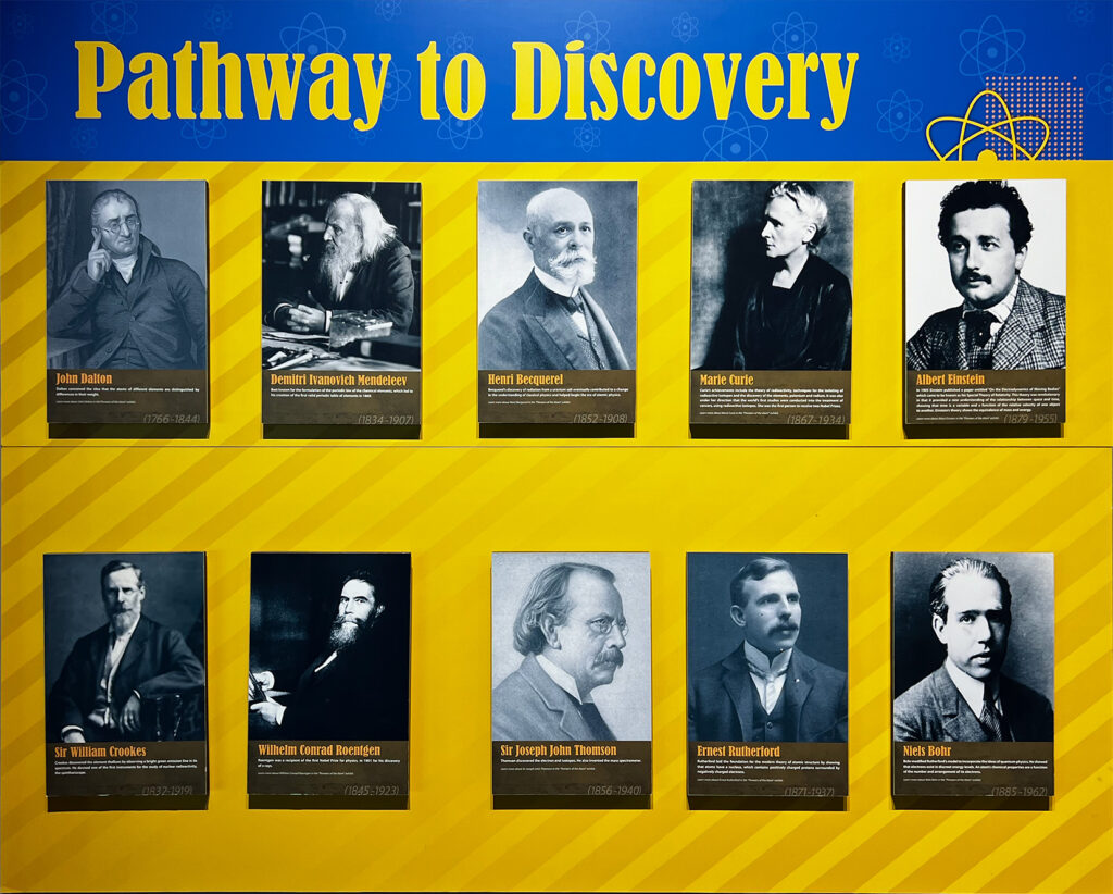
The pathway to our understanding of the universe was led by the brightest minds of their time. These are my heroes. The world we live in now would not exist without them.
One hundred years earlier, scientists could not even agree on what matter was. They thought there must be a luminiferous aether that light travels through. One hundred years later, scientists now were beginning to understand the star stuff. We cracked the code, so to speak.
After stars formed in the early universe, things really got interesting.
It was a boomtown in Albuquerque! Events that followed that test put the town front and center in the race to exploit our understanding. Sandia National Laboratories and nearby Kirtland AFB were front and center of the development of nuclear weapons. Research and development were being done on the peaceful uses of atomic energy, like the EBR-I reactor I visited earlier on the trip.
Atomic energy quickly became part of our culture.
The Atomic Bomb quickly became part of Americana, as evidenced by Miss Atomic Bomb and some of the toys available at that time. It meshed nicely with the Space Race and the environment I grew up in. No wonder it appeals so much to me.
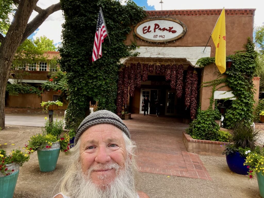
Dave told me that he ate at a restaurant called El Pinto when he was once visiting on business. I tried it – it was killer good, and the setting was very unique. They have a factory next door where they make salsa.
El Pinto in northwest Albuquerque
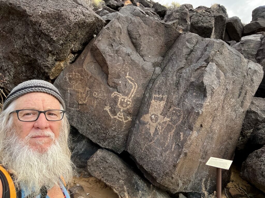
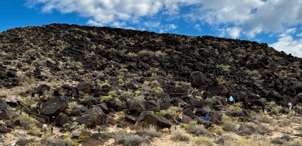
Petroglyph National Monument
I left early by myself to explore the petroglyphs. They allowed dogs but only on certain parts of the trails, excluding the petroglyphs. I decided to go to Boca Negra Canyon, out of the three different trails.
Boca Negra Canyon at Petroglyph National Monument. The petroglyphs are estimated to be between 300 and 700 years old.
The park sits on different pieces of land in western Albuquerque. The Boca Negra Trail was in sight of a housing development! The trail consisted of concrete steps and paved surfaces that let you get right up to the rocks.
Boca Negra Trail with over 100 petroglyphs
It is estimated the petroglyphs were done primarily between 13o0 and the late 1600s by the ancestors of the Pueblo people. They were created by scraping the rock varnish off with a hammer and chisel. The feature images from nature and daily life.
The Freeway Dash
On my way back from my exploration of the petroglyphs, I saw a most interesting sight.
It was clear from the moment I got here that Albuquerque is a dangerous place—lots of barred windows and gated communities. The RV park has an all-night security guard and a closed gate after hours.
So I wasn’t all that surprised as I neared the exit to see a tall young man jump over the Interstate fence carrying two large boxes. As I sped by at 75 MPH, I looked in my rearview mirror to see him dart across five lanes of traffic carrying the boxes. He would have then had to scale another fence and cross the other five lanes of traffic in the opposite direction, scale the last fence, and make his getaway.
Yes – a dangerous place indeed. And apparently full of idiots.
The National Museum of Nuclear Science & History
This is one of the best museums I have been to in a long time. The exhibits were very good, and you could tell from the many sponsorship plaques in evidence a lot of money too. Their collection was unique, like the Palm Springs Air Museum I visited at the beginning of the trip.
The displays and exhibit take the viewer through the scientific minds and discoveries made that led to the testing of the Gadget. It does a remarkably good job of explaining the science.
Stunning 🤩 re-creation of the labs that were used in the development of the Gadget. This involved verifying the predictions of the critical mass required to start an uncontrolled fission chain reaction.
I was in tears when I entered the room showing the experiments the scientists did to verify their research.
Device for measuring neutron flux density of the coreDevice used to determine critical massReplica of the internal assembly of the GadgetReplica of the internal assembly of the GadgetCritical mass experimentCritical mass experimentCalculator used to calculate very large numbers
From here, there was a large collection of exhibits leading up to Hiroshima, including a B29 Bomber used to drop the bomb.
B29 Bomber similar to the ones used to drop the two bombs on Japan
This included a replica of the Trinity test stand. This held the Gadget when it was tested on July 16, 1945, about 100 miles south of here.
A series of exhibits and displays discussed the cold war and the numerous ingenious ways we had to ensure Mutual Assured Destruction.
Around this time in my young life, we practiced air raid drills at elementary school during the Cuban Missile Crisis. I remember thinking to myself, ‘What good is it going to do if I am sitting under this desk and they drop a nuke on us.’ Yes – an exciting time to be alive.
Many years later, I was working at Boeing. I had to get a security clearance because they were working on Cruise Missiles in the building our lab was located in.
These would be on dollies out in the corridors of my building. I would walk by them on the way to lunch 🤣!
Display of what’s commonly referred to as the Nuclear Football – the machine that would authorize the launch of nuclear weapons by the President. The latest in the lower right was from the 1990s and featured a Compaq computer laptop 😳.
There were a lot of schoolchildren at the museum. There were a number of exhibits designed for children as well as exhibits on the atomic age in popular culture.
Atomic Pop Culture! We visited Arco earlier in this trip with a visit to the EBR-I reactor museum there.
The was a special exhibit on the Uranium Cube. This is a five-pound chunk of pure Uranium made by Nazi Scientists who then hung over 600 of them in an array to achieve a chain reaction.
Pure Uranium cube 2 inches square and weighs 5 pounds. Over 600 of these were built by Nazi Scientists in 1945
Most of the cubes are unaccounted for, but very few remain and are among the amazing exhibits at this incredible museum. This experiment was located in Haigerloch, Germany, near where I lived in the late 1980s.
Heisenberg’s Uranium Machine
Another part of the museum was dedicated to the current technology of atomic energy for power production. A series of displays on the work that is being done with Thorium based reactors moderated by liquid sodium.
Display on the Thorium fuel cycle for power generation
Nothing new here – I was very interested in doing this when I graduated from college. I tried to get a job at Gulf General Atomic, which had built a similar design reactor at Fort St Vrain in Colorado.
Matador Flying Rocket
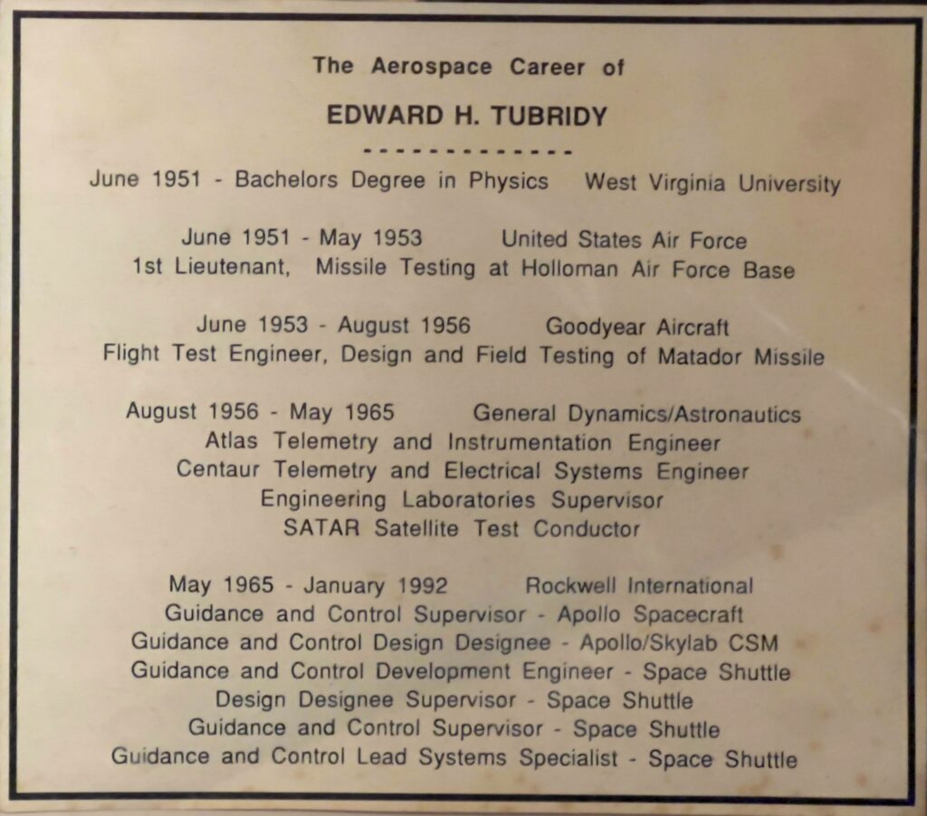
Outside was an extensive collection of aircraft, missiles, and other items. The Matador was a flying rocket, much like the original V2 Buzz Bomb built by the Nazis. My Dad worked on this during his time with Goodyear in Alamagordo.
Dad’s Career 1951-1992. He worked on the Matador after leaving the Air Force in 1953.
I could not believe all of this was in a place like this. It touches on a lot of things that I am very interested in now and over the course of my life. I was crying at several points it touched me so. Go figure.
The rest of the day was spent either heating up in the hot tub or cooling down from the 100+ F weather!
Albuquerque KOA – Winner of the Best Hot Tub category for Excellent Adventure 2023
The next day we left early for the final stage of the Miss Atomic Bomb tour.
Trinity
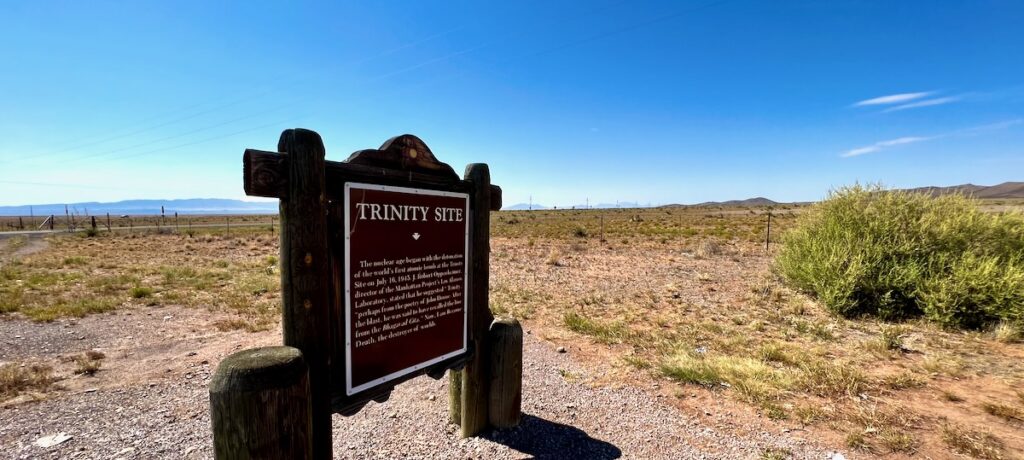
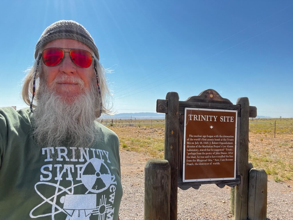
The Trinity Site is located here. About 100 miles or so south of Albuquerque, just south of Highway 380. There is a marker to the northeast of the site. I was told there are often protestors there, and the marker gets frequently damaged.
Historic Marker for Trinity Site 18 miles southeast of this location. It is closed except for two days a year.
Not today.
Trinity and Me
How can I save my little boy from Oppenheimer’s deadly toy? There is no monopoly on common sense On either side of the political fence We share the same biology, regardless of ideology Believe me when I say to you I hope the Russians love their children too


